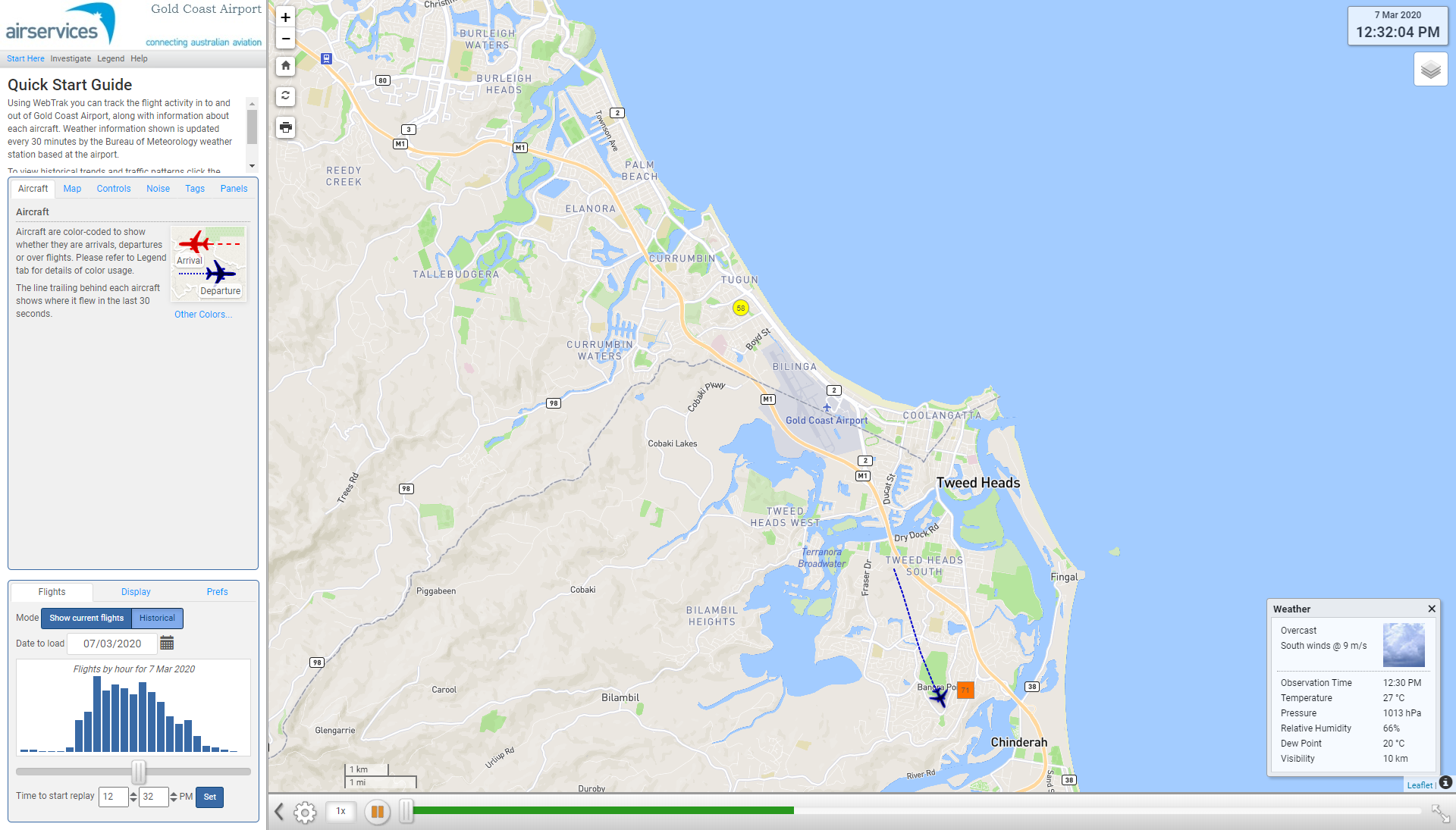
Airport curfew
An airport curfew is a legislated restriction on aircraft operations at a federally-leased airport during a specified time period.
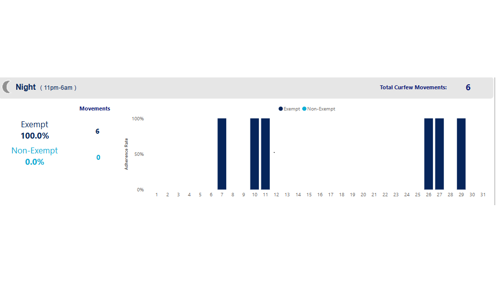
Gold Coast Airport is operational 24 hours a day, however, there is a curfew in place which restricts operations in and out of Gold Coast Airport during the hours of 11pm to 6am. During daylight saving time the airport curfew operates on Queensland time so New South Wales residents will see aircraft movements until 12 am instead of 11 pm.
While most aircraft operations are prohibited during this period, emergency aircraft, some small jets, propeller-driven aircraft and freight movements are allowed. The curfew limits what aircraft can land and take-off and, in some cases, the runways that can be used.
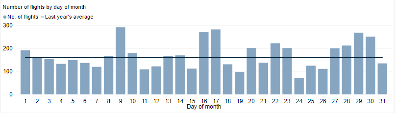
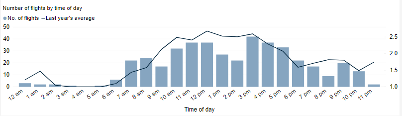
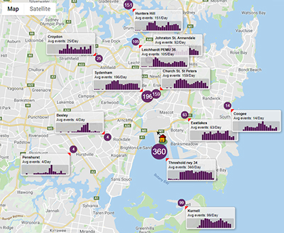
Curfew movements at Gold Coast Airport are small in number – on average less than one per night.
Curfews are legally enforceable and regulated by the Department of Infrastructure, Transport, Regional Development, Communications, Sport and the Arts, who can make a determination of a curfew violation and prosecute an airline or aircraft operator for breaching a curfew.
The report is best viewed in full screen mode.
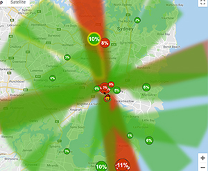
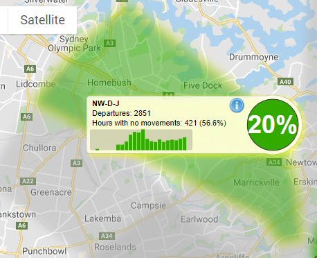
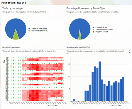
Note: Due to rounding, percentage values may not sum to exactly 100.0%. Minor discrepancies of up to ±1% are expected and do not indicate any errors in the underlying absolute figures, which remain accurate and unaffected.
Note: Non-permitted movements are those that do not meet standard exemption criteria; however, this does not necessarily indicate non-compliance, as dispensations or other approvals may have been granted outside of standard classifications. Curfew dispensations can be found here: Curfew Dispensation Reports.