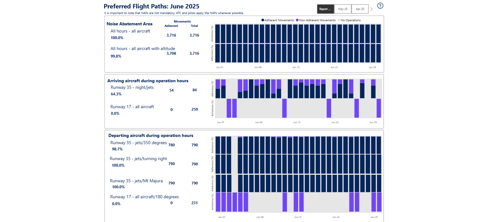
The NAP lists the preferred flight paths as:
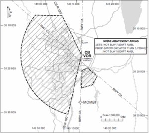
2.1 Noise Abatement Area
A designated Noise Abatement Area covers most of Canberra and Queanbeyan.
Preferred routing avoids this area whenever possible.
If aircraft must fly over the area:
- Jet aircraft must stay above 7,000 feet AMSL.
- Propeller aircraft over 5,700 kg maximum take-off weight must stay above 5,000 feet AMSL.
Note: The Noise Abatement Areas do not apply to:
* Emergency or medical priority operations.
* Operations avoiding hazardous weather.
* TWR circuit training operations
* Unplanned missed approach operations
(2.1.b) All hours – aircraft with minimum altitude
We have become aware of an error in the reporting of this NAP as the height of the aircraft was calculated using the height above ground rather than the height above mean sea level as stated in the NAP. We have corrected the results and backdated these to correct the error.
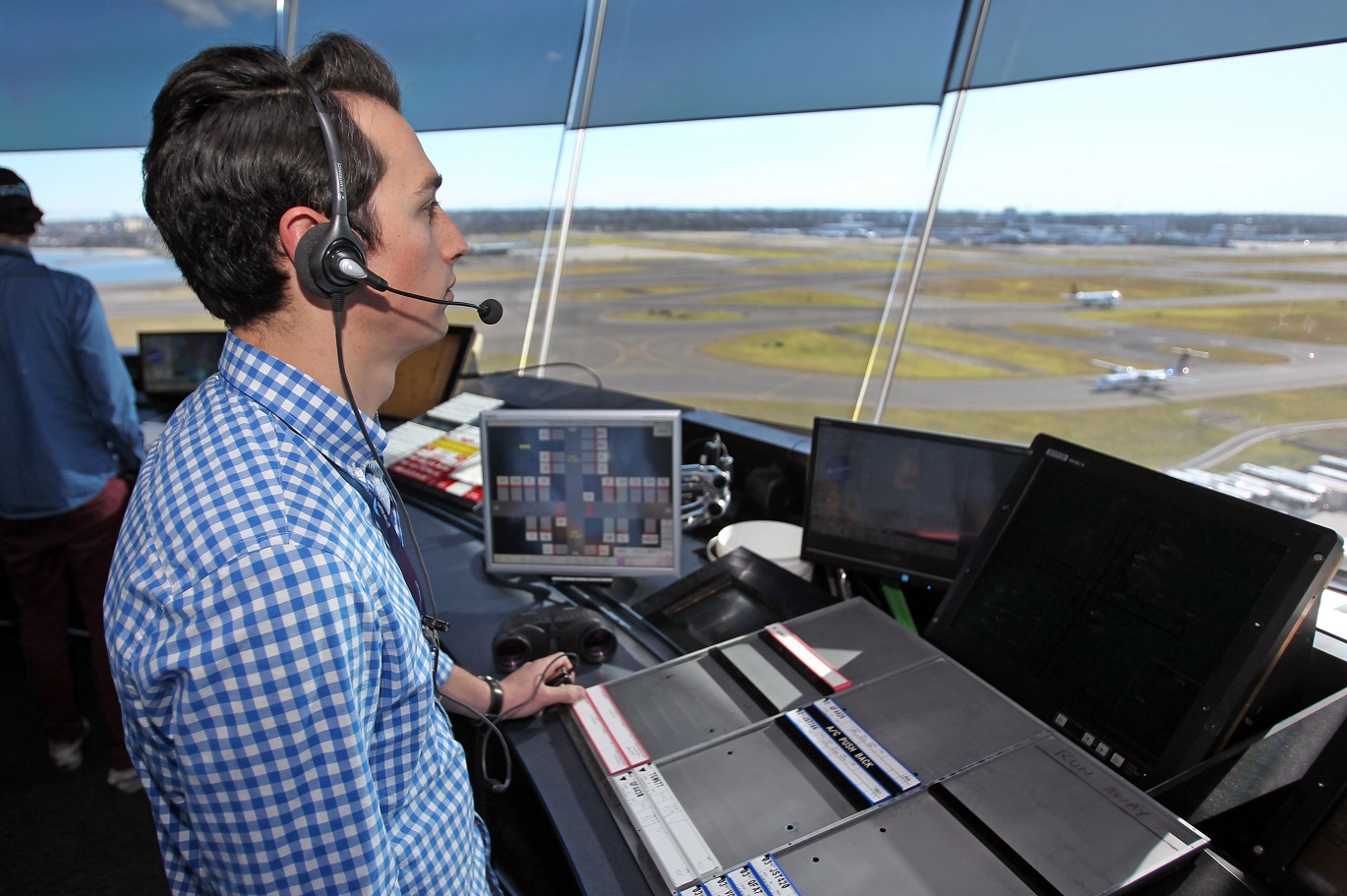
Adherence with this procedure is reported below.
2.2 and 2.3 Arrivals
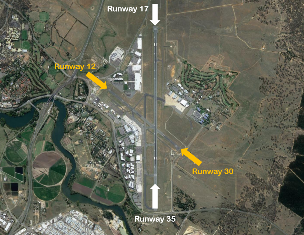
Runways 35, 17, 30 and 12
- 2.2.a: Runway 35: At night: jets will be vectored to be on final approach no closer than MOMBI.
- 2.2.b: Runway 17: Aircraft on right base will be vectored to be on final approach no closer than 4 DME CB.
- 2.2.c: No specific procedures apply.
- 2.3.a: Runway 35 or 17: IFR aircraft required to conduct a straight-in approach.
- 2.3.b: No specific procedures apply.
- 2.3.c: Data not available
Adherence with this procedure is reported below.
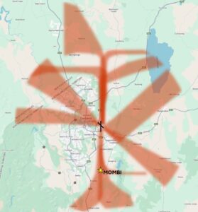
2.4 and 2.5 Departures
Runway 35 Departures
- 2.4.a.1: Jets will usually be assigned a heading of 350° after take-off.
- 2.4.a.2: Jets turning right must climb to at least 4,500 feet before turning.
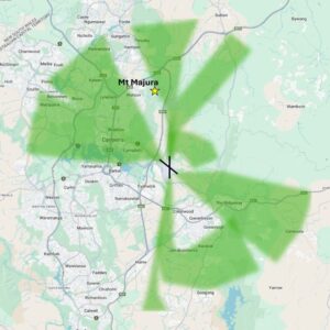
- 2.4.a.3: Jets turning left must pass Mt Majura before starting the turn.
- 2.5.a.1: Jets will usually be assigned a heading of 353° (SID).
- 2.5.a.2: Jets must climb to at least 5,000 feet before turning.
Adherence with this procedure is reported below.
Runway 17 and 30 Departures
- 2.4.b: Runway 17: Heading of 180 degrees until clear of Noise Abatement Area.
- 2.5.b: Runway 17: Follow SID.
Adherence with this procedure is reported below.
NAPs not currently reported on
Reporting options are currently under review for the following NAPs, where data is not currently available.
- 2.2.d: Pilot requirement for landing runway 12 during tower hours.
- 2.3.c: Pilot requirement for landing runway 12 outside tower hours.
- 2.4.c: Pilot requirement for departure runway 30 during tower hours.
- 2.4.d: Pilot requirement for departure runway 12 during tower hours.
- 2.5.c: Pilot requirement for departure runway 30 outside tower hours.
Note: Air Traffic Control may adjust paths for weather and/or traffic conditions.
Standard Instrument Departures (SID) and Standard Instrument Arrivals (STARs) are published flight paths designed to enhance safety, efficiency, and predictability. Air traffic control (ATC) may issue a deviation to a SID or STAR due to weather and/ or traffic conditions
The report below provides the percentage adherence against the NAP criteria for preferred flight paths.
The report is best viewed in full screen mode.
Note: Due to rounding, percentage values may not sum to exactly 100.0%. Minor discrepancies of up to ±1% are expected and do not indicate any errors in the underlying absolute figures, which remain accurate and unaffected.