Investigation: Departures during curfew

During the curfew (11pm to 6am) aircraft that are permitted to operate must depart towards the south over the water from Runway 16R (the western most of the parallel runways). The flight path used during the curfew is closer to the coast than the flight path used during the day.

The Aircraft Noise Ombudsman asked us to investigate whether it was feasible to move the curfew flight path further away from the coast. We found this was feasible but a more practical solution was to make the daytime jet departure path available for the non-jet aircraft that fly during curfew.

This would improve noise impacts during the curfew by moving aircraft further east of Cronulla, Bundeena and nearby areas. 

The change was implemented from 9 November 2017.

Further information about the change can be found on the Airservices website.

Cambridge Airport circuits

The majority of General Aviation (light aircraft) operations are conducted to or from Cambridge Aerodrome.

Air traffic control do not provide runway separation or information on traffic operating on the manoeuvring area to Cambridge Aerodrome, however, during tower hours (5:50am to 10:10pm) Hobart Tower provides information for Cambridge aerodrome traffic.

Rotor-Lift Aviation also conduct circuit training at Hobart Airport and winch training at Seven Mile Beach and at Pawleena. 

To learn more about Cambridge Airport operations, take a look at our Cambridge Airport Flight Paths page.

Where are the circuits at Hobart?

By day most of the circuit training is conducted on the west of the aerodrome over the suburbs of Cambridge, Mount Rumney and Acton Park, while at night it is done to the eastern side of the aerodrome over Hobart airport and Barilla Bay. Regular use is also made of the Ralphs Bay Flying Training area adjacent to the suburbs south of Lauderdale.

General aviation traffic operating beyond the Cambridge circuit are not constrained to set routes however geographical limitations, preferred operating routes and the need to segregate these operations from jet traffic means that there tends to be a higher concentration of aircraft operating to and from the Hobart City area to the west and to from the Midway Point/ Sorrell areas to the East (and beyond).

What is circuit training?

Circuit training is the first stage of practical pilot training focused on take-offs and landings. It involves the pilot making approaches to the runway or helipad, touching down and then applying power to take off again. This is undertaken in accordance with Civil Aviation Safety Authority (CASA) Regulations which are consistent with international practices.

How are circuits flown?

A training circuit consists of five legs – take-off, crosswind, downwind, base and final approach to the runway.

Aircraft take off into the wind, climb to 500 feet and then turn onto the crosswind leg. They continue to ascend to 1000 feet and turn onto the downwind leg. Having turned onto the base leg the descent commences. After turning onto the final leg and lining up with the runway the aircraft will touch down and take off again.

For left-hand circuits, the pilot turns left after take-off and flies anticlockwise. For right-hand circuits, the pilot turns right and flies in a clockwise direction.

A simplified representation of a left-hand circuit is shown above

Investigation: Departures over Banora Point

In 2016, complainants living in Banora Point raised the issue of Virgin Australia Boeing 737s making early turns over residential areas on departure from Runway 14. We investigated the complaints and confirmed this was occurring.

Virgin Australia subsequently discovered a variation with the way some crews were entering data into the aircraft’s flight management system and issued a crew notice to correct this.

Since the notice took effect there have been no further complaints from residents.

Investigation: Altitude of departures over Fingal Head

In 2016, a complainant raised a concern that Air Asia flights varied in altitude, with an evening flight being lower than a morning flight.

Our investigation found that there was an altitude difference, but that this was due to the different destinations of each flight. The morning flight was bound for Auckland, a much closer port than the destination of the evening flight, Kuala Lumpur.

The evening flight therefore carried a higher load of fuel to cover the distance of 6,500 kilometres to Malaysia compared to the 2,200 kilometre distance to Auckland. The weight of an aircraft affects its climb performance and it was this effect being noticed by the complainant.

Learn more about aircraft altitudes on our What are the rules about altitudes? page

RAAF Amberley

The Air Force undertakes routine flying activities at RAAF Base Amberley. The majority of the flying training occurs in designated training areas, situated over farming, rural and overwater areas, which helps reduce the time aircraft spend over residential areas.

Amberley Flying Training Areas include:

  • Western Training Area: The western training area is essential airspace for training all RAAF Base Amberley aircraft including the F/A-18F Super Hornet, KC-30A Multi Role Tanker Transport aircraft and the C-17A Globemaster III. The western training area airspace is located west of RAAF Base Amberley and commences south west of Toowoomba.
  • Over water training areas: The Northern Training Area, Northern Bridge, Central Training Area, Southern Training Area, and Southern Bridge are airspaces located overwater to the East of the coastline.
  • Evans Head: The Evans Head Air Weapons Range is primarily used by Amberley based F/A-18F Super Hornets to conduct ground attack training. This is the only weapons range within the training radius of the F/A-18F Super Hornet aircraft from their home base at Amberley.

Noise Mitigation

The Department of Defence Aircraft Noise Management Strategy outlines how they work with local communities to reduce noise impacts, while balancing operational and training requirements.

Flying operations are conducted in consideration of local communities, whilst maintaining the safe operation of the aircraft. More information can be found in the:

You can access more information on military aircraft activity at:

Archerfield Fly Neighbourly

Fly Neighbourly Advice or Fly Neighbourly Agreements are voluntary agreements established between aircraft operators and communities or authorities (normally airports or local councils) to assist in reducing the impact of aircraft noise on local communities. Archerfield Airport has a voluntary Fly Neighbourly program, which encourages pilots to fly in a noise sensitive way whenever possible.

Will flights increase in the future in my area?

Flight Path and Airspace Changes

Visit Engage Airservices to engage with our program of flight path and airspace changes.

Airport Master Plans

Airport Master Plans provide a blueprint for the future development of an airport over a twenty year period. They include information on forecast growth, airport terminals and facilities, runways and flight paths.

Who is responsible for master planning?

Airports are responsible for producing the master plan, while the overall process is administered and regulated by the Department of Infrastructure, Transport, Regional Development and Communications.

Brisbane Airport

The Brisbane Airport Master Plan can be found on the Brisbane Airport website.

Unusual activity

We regularly receive calls about unusual or irregular aircraft activity or airport operations.

Aircraft may not fly on the published flight path for a number of reasons. You can learn more on our Do planes have to stay on flight paths? page.

Some other common reasons we are contacted are:

Circuit Training

At major general aviation airports around the country including Bankstown (NSW), Archerfield (Qld), Moorabbin (Vic), Parafield (SA) and Jandakot (WA), flight training schools regularly conduct circuit training. Circuit training sees aircraft, usually small single engine propeller aircraft, fly over the surrounding suburbs at a height of approximately 1,000 ft (305 metres).

Low level flights

Occasionally, aircraft and helicopters fly at low levels for reasons including law enforcement, rescue and military operations, aerobatic or air show displays.

More information is available on our What are the rules about helicopters? page and What are the rules about altitudes? page.

Equipment testing & calibration

We are responsible for conducting regular flight calibration inspections on around 500 navigational aids nationwide.

This involves a specially-equipped aircraft conducting numerous ‘missed approaches’ to test and calibrate equipment usually at low level. In order to fully check the equipment several passes are required and the aircraft may remain in the area for an extended period of time.

Whilst we take measures to reduce the impact of these inspections, they are required to maintain safety of the entire aviation system and on occasion we may need to undertake these at sensitive times.

Smoke and flames from an airport

We regularly conduct training exercises around the country for aviation fire fighters which involve the creation of large amounts of smoke and flames. There may also be an unusually high number of emergency vehicle movements. The appearance of smoke and flames at an airport does not mean there has been an accident or that there is any concern for aircraft safety.

The Brisbane Noise and Flight Path Monitoring System (NFPMS)

We collect noise and operational data from ten long term noise monitors (NMT) around Brisbane Airport. As part of the new runway opening we worked with BAC to install four additional short term noise monitors which are currently in place until July 2022. These short term noise monitors are located at Bardon, Carina, Hamilton and New Farm.

Long term noise monitors are listed below according to their location.

Access monthly data on our Brisbane noise monitoring reports page.

Tingalpa and Nudgee Beach

NMT 2 (Tingalpa)

Tingalpa (NMT 2):

Captures departures from Runway 19L to the south and arrivals to Runway 01R from the south.

NMT 3 (Nudgee Beach)

Nudgee Beach (NMT 3):

Captures departures from Runway 01L/19R to the north and arrivals to Runway 19R from the north.

Bulimba and Kedron

NMT 63 (Bulimba)

Bulimba (NMT 63):

Captures arrivals to Runway 01L and 01R and departures to the north from Brisbane Runway 19L and 19R.

NMT 54 (Kedron)

Kedron (NMT 54):

Captures arrivals to Runway 01L and departures from Runway 01R and 19R.

Cannon Hill and Annerley

NMT 55 (Cannon Hill)

Cannon Hill (NMT 55):

Captures arrivals to Runway 01L and 01R and departures to the north from Brisbane Runway 19L and 19R.

NMT 9 (Annerley)

Annerley (NMT 9):

Captures arrivals to Runway 01L and 01R and departures from Runway 19L and 19R.

Salisbury and St Lucia

NMT 10 (Salisbury)

Salisbury (NMT 10):

Captures arrivals to Runway 01L and 01R, including ILS approaches.

Due to proximity to Archerfield Airport, some aircraft from Archerfield Airport which operate to the north-east of the airport will also be captured.

NMT 11 (St Lucia)

St Lucia (NMT 11):

Captures arrivals to Runway 01L and departures from Runway 19L and 19R.

Runway Ends

NMT 61 (Runway End 19L)

Runway End 19L (NMT 61):

Captures arrivals to Runway 01R and departures from Runway 19L.

NMT 62 (Runway End 19R)

Runway End 19R (NMT 62):

Captures arrivals to Runway 01L and departures from Runway 19R.


Learn more about monitoring aircraft noise on the Airservices website.

When is each flight path used?

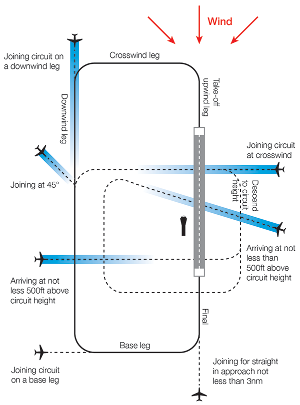
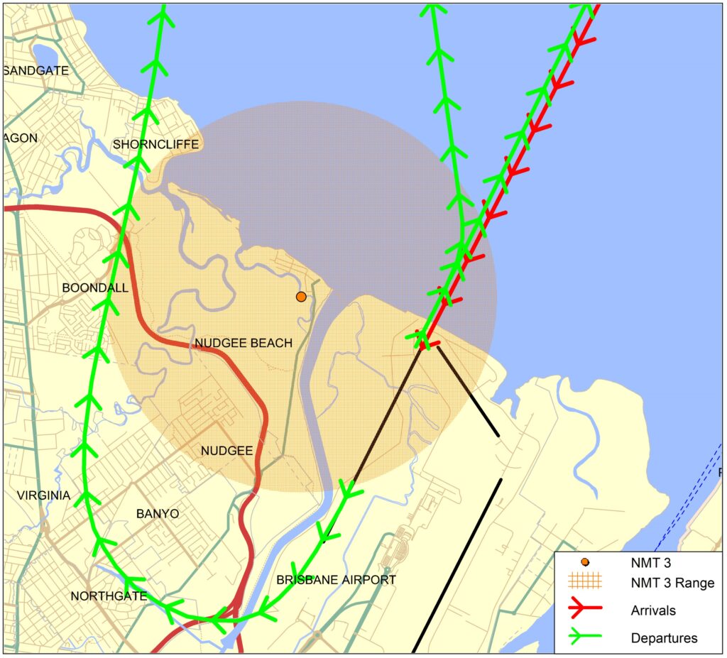
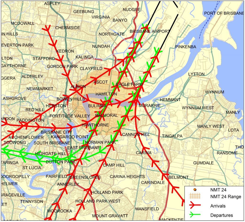
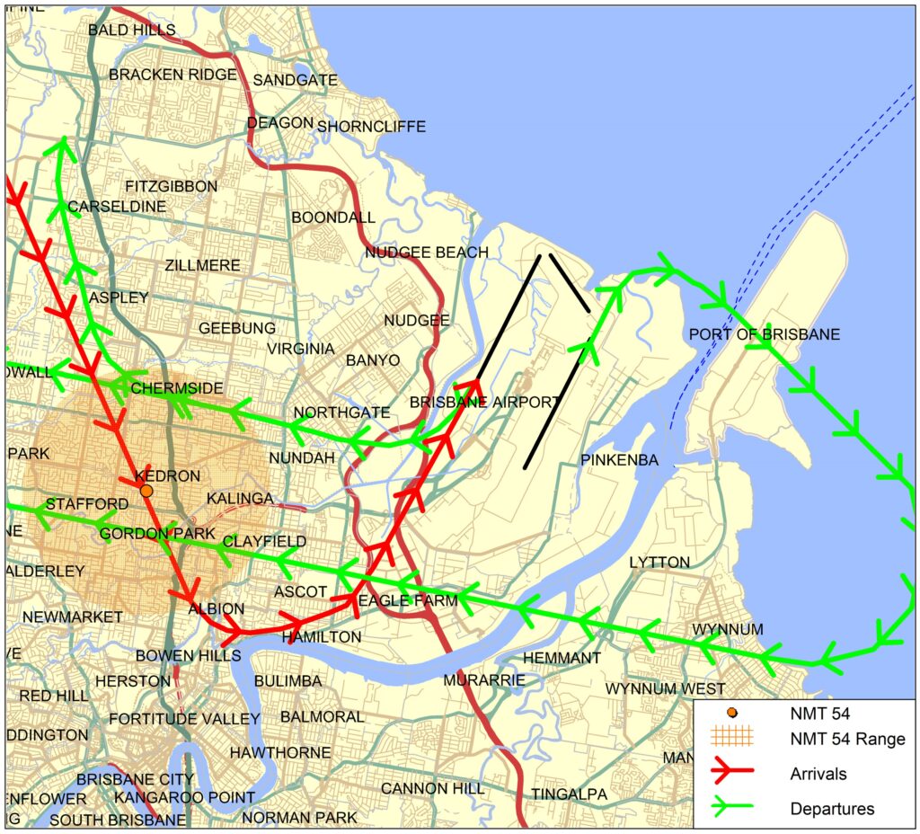
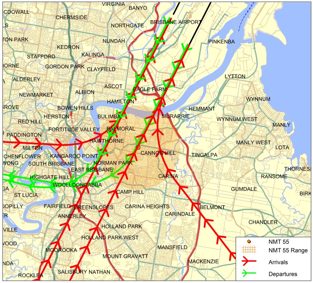
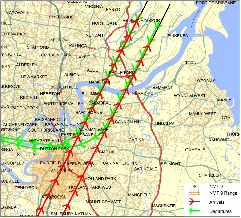
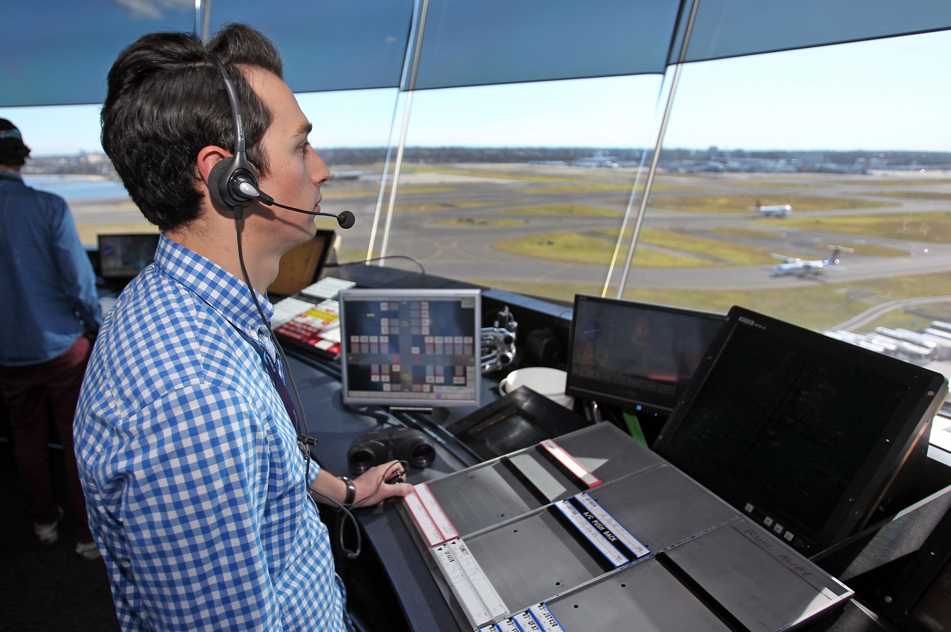
Air traffic control manage the traffic to each runway at an airport using a range of operations which can include clearing aircraft to use published flight paths, issuing visual approaches or vectoring for separation and sequencing. As the runway in use changes, the types of operations in use will also change, and so different suburbs and areas are affected by aircraft movements.

Flight paths do not operate in isolation. They are part of an interconnected network. Flight paths need to accommodate aircraft operating constraints, provide terrain clearance and fit into the overall airspace design.

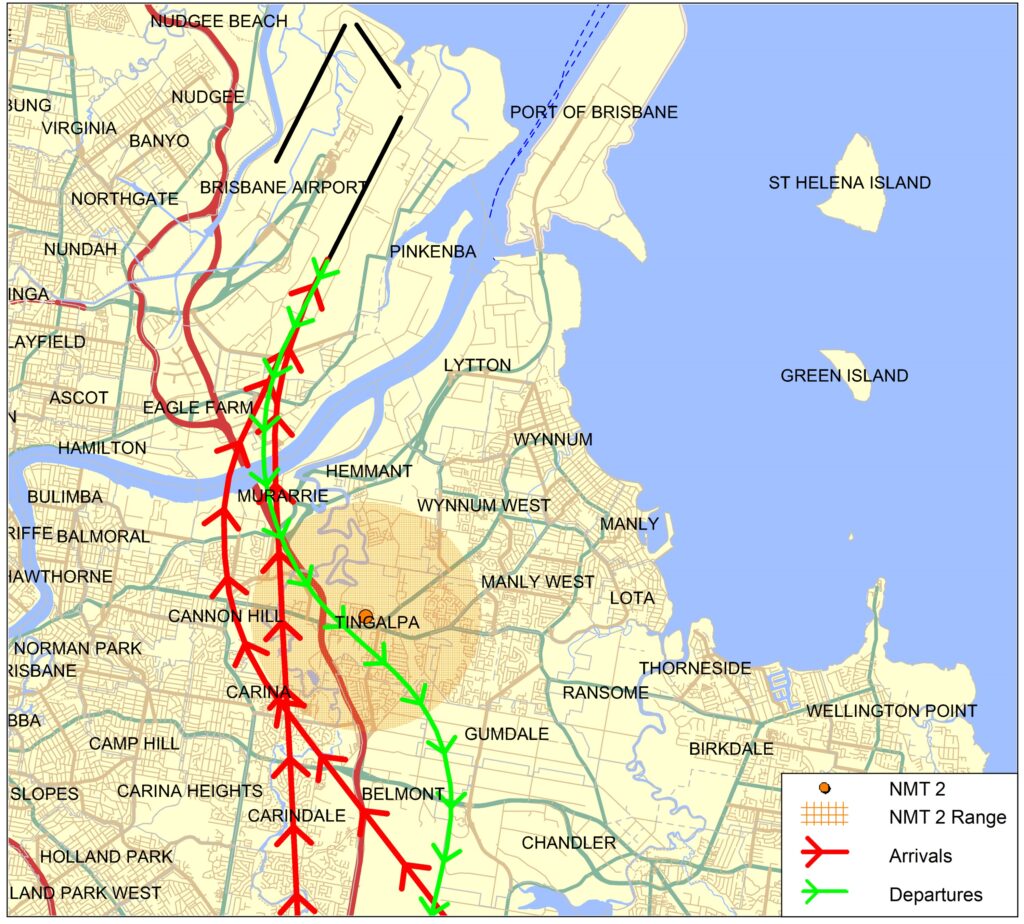
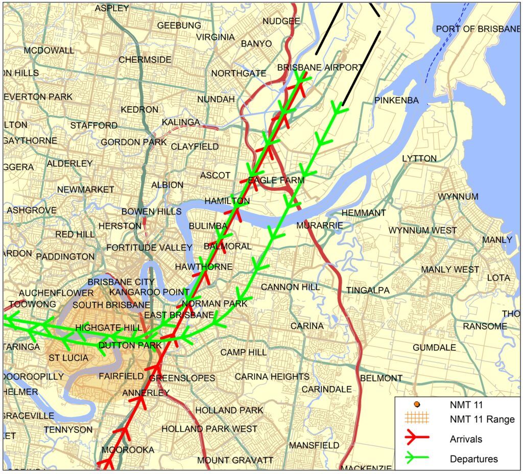
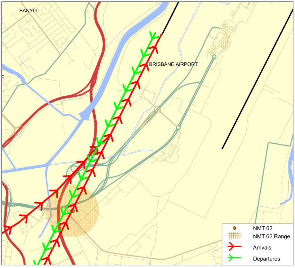
Flight paths at Hobart Airport are designed as standardised tracks that segregate arriving aircraft from departing aircraft.
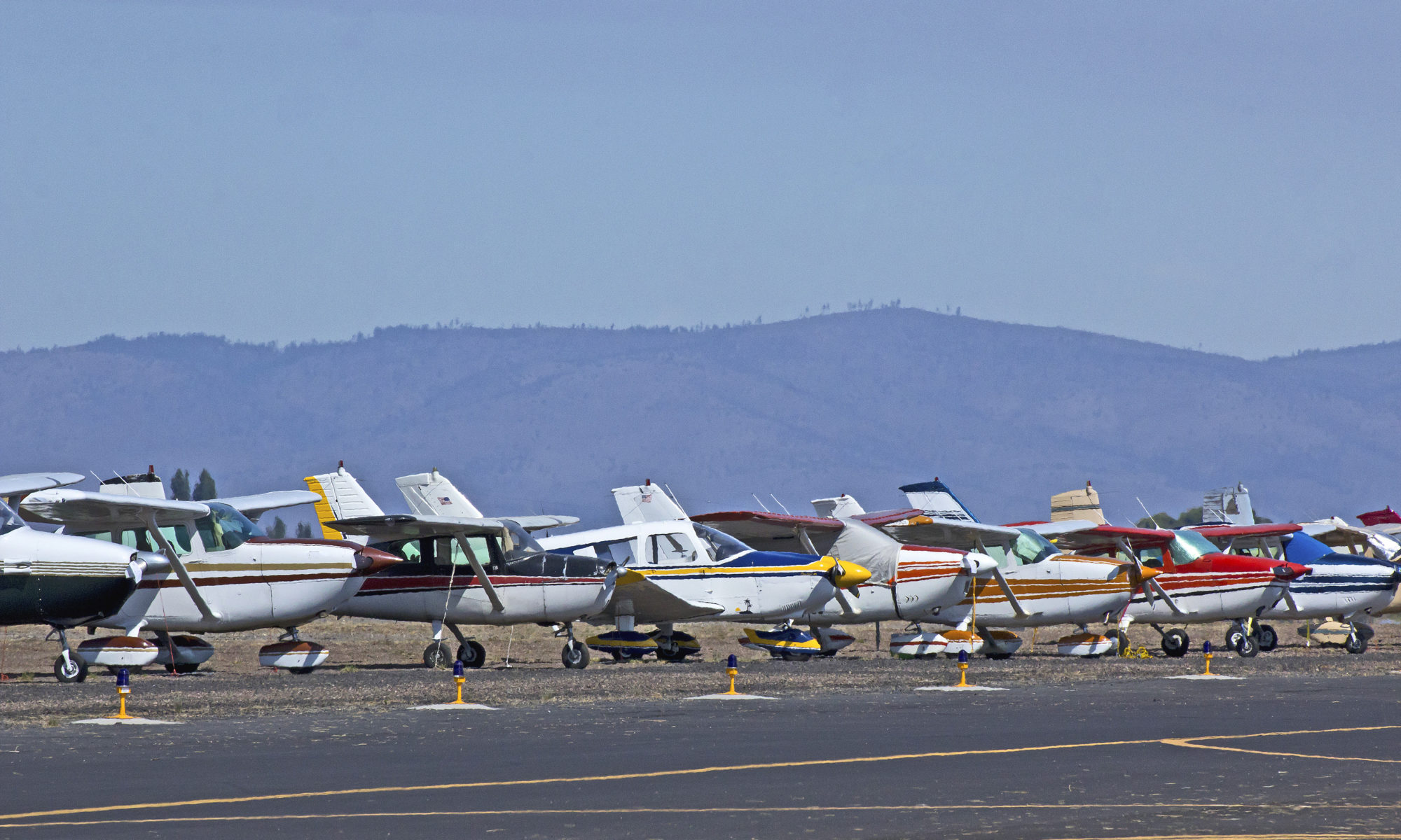
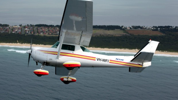
Arrivals

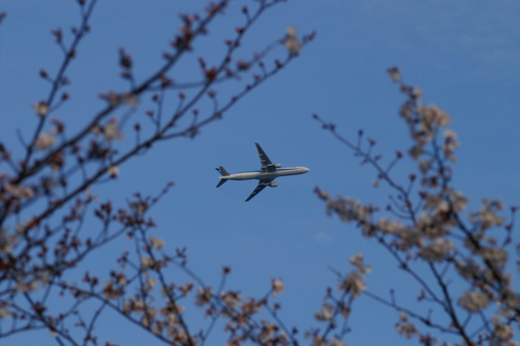
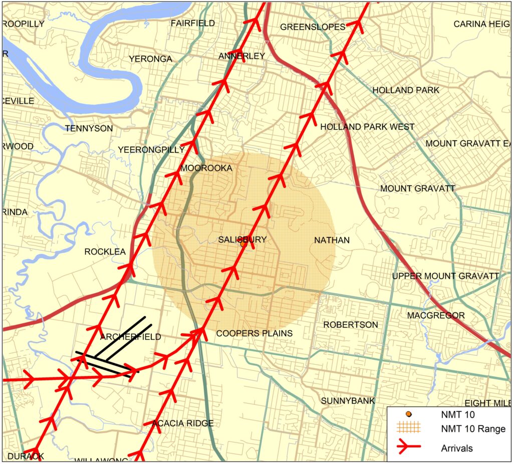
Jet arrivals into Hobart Airport are generally aligned with the runway approximately 10 kilometres from the runway. From this point, they fly towards the runway in a straight line. This means suburbs and towns in line with the runway are overflown by arriving aircraft. Other suburbs and towns may be overflown by aircraft travelling to join the final approach to align with the runway.

There are two approach paths for each end of the runway, which are used depending on the technology available on-board arriving aircraft. Aircraft can either join the final approach path closer to the airport or, if they do not have the required technology, they can join it approximately 15-18 kilometres from the runway.

The altitude the aircraft will be at when it begins its final approach will depend on the remaining distance of flight to the runway. There is a regulated minimum altitude for aircraft at all stages of arrival that is determined by the height of terrain in the vicinity of the aircraft, however aircraft are usually well above this minimum altitude. Aircraft will generally descend on a glide slope of three degrees.

Departures

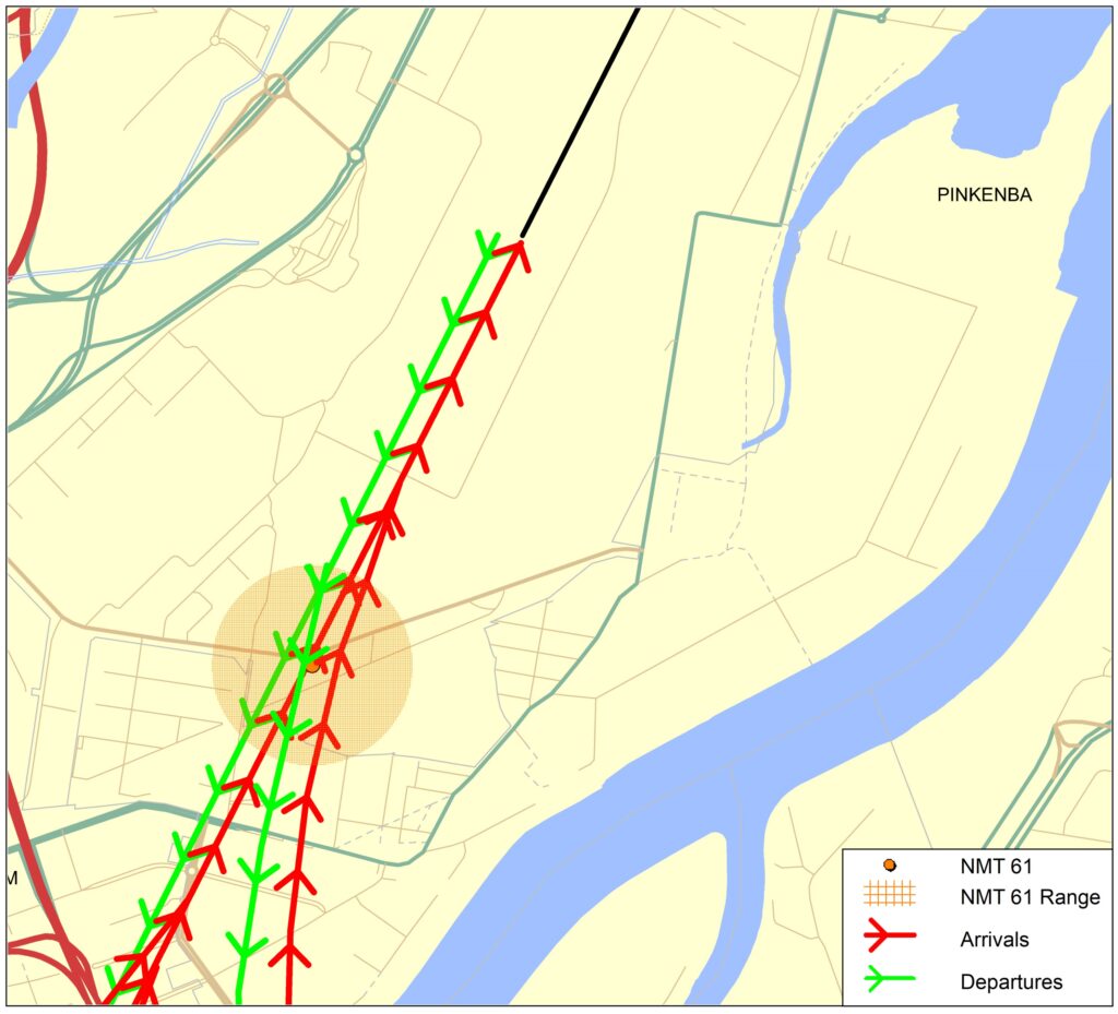
Departure flight paths allow aircraft to maintain the runway heading for a short time until they are stabilised in flight, before heading to their destinations. Departure paths also take into consideration any arrival paths or other departure paths that may need to be crossed.

There are separate departure paths for jets and non-jets at Hobart Airport. Jet departures continue straight ahead in their take-off direction for at least 13km before turning. Non-jets are turned off towards their headings sooner after departure. The purpose of non-jets turning sooner aims to make separation and traffic management simpler for air traffic control and improve airport efficiency.

The altitude of aircraft after departure depends on factors, including wind direction and speed, temperature, air pressure, aircraft type and aircraft weight (this can vary depending on passenger numbers and fuel load). All these factors affect an aircraft’s climb rate. There are regulated minimum altitudes (based on terrain heights in the vicinity of flight paths) for aircraft departing a runway, however performance of modern aircraft usually result in aircraft being much higher than minimum regulated altitudes. Aircraft taking off generally climb at a higher gradient than aircraft landing. Minimum altitudes are governed by international standards.


Learn more about how the runway is used on our Hobart Airport Runway page.