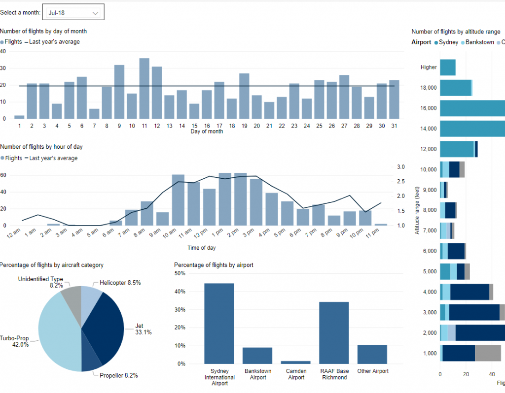
Use this interactive tool to explore detailed data for your area in the month of your choice.
This report is best viewed in full screen mode.
Use this interactive tool to explore detailed data for your area in the month of your choice.
This report is best viewed in full screen mode.

Federally-leased airports (excluding Mt. Isa and Tennant Creek) have established Community Aviation Consultation Groups (CACGs), which provide an effective avenue for local community engagement on airport planning and operations, including aircraft noise. The Department for Infrastructure, Transport, Regional Development and Communications provides guidelines for CACGs.
Non federally-leased airports may also choose to establish CACGs or community forums.
CACG membership depends on the characteristics of the airport and any local issues of community concern however, generally includes:
Airservices does not formally belong to CACGs, but is invited to attend to provide relevant information and assist in discussions. We engage with CACGs on flight path and airspace changes, as well as technical reviews, such as noise monitoring and noise abatement procedures.
Find out more information on the Brisbane Airport Community Aviation Consultation Group webpage.
The Air Force undertakes routine flying activities at RAAF Base Amberley. The majority of the flying training occurs in designated training areas, situated over farming, rural and overwater areas, which helps reduce the time aircraft spend over residential areas.
Amberley Flying Training Areas include:
The Department of Defence Aircraft Noise Management Strategy outlines how they work with local communities to reduce noise impacts, while balancing operational and training requirements.
Flying operations are conducted in consideration of local communities, whilst maintaining the safe operation of the aircraft. More information can be found in the:
You can access more information on military aircraft activity at:
Fly Neighbourly Advice or Fly Neighbourly Agreements are voluntary agreements established between aircraft operators and communities or authorities (normally airports or local councils) to assist in reducing the impact of aircraft noise on local communities. Archerfield Airport has a voluntary Fly Neighbourly program, which encourages pilots to fly in a noise sensitive way whenever possible.
Visit Engage Airservices to engage with our program of flight path and airspace changes.
Airport Master Plans provide a blueprint for the future development of an airport over a twenty year period. They include information on forecast growth, airport terminals and facilities, runways and flight paths.
Airports are responsible for producing the master plan, while the overall process is administered and regulated by the Department of Infrastructure, Transport, Regional Development and Communications.
The Brisbane Airport Master Plan can be found on the Brisbane Airport website.
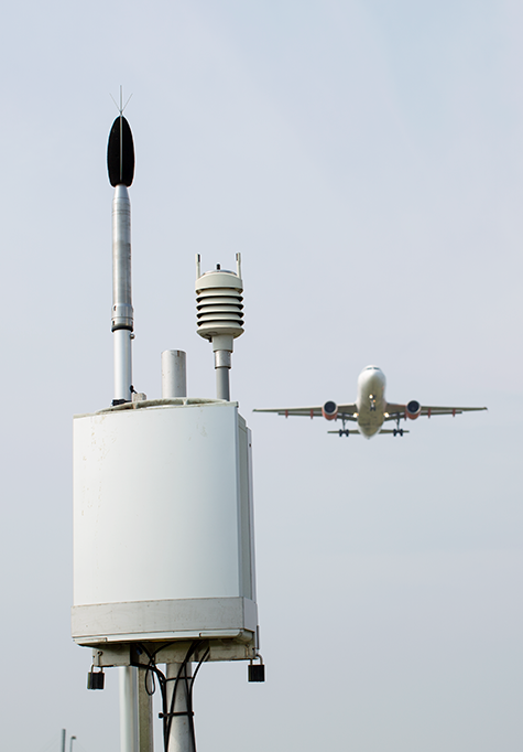
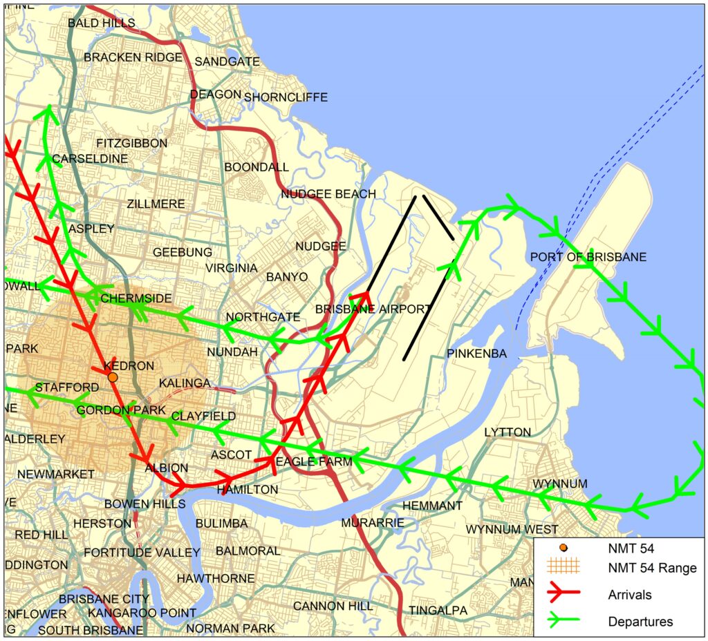
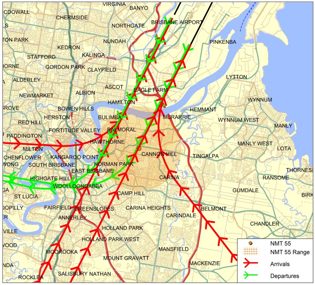
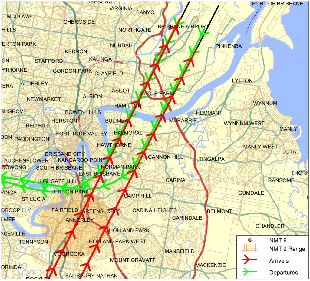
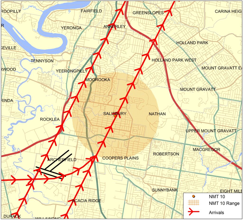
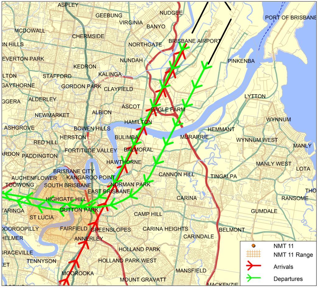
We collect noise and operational data from ten long term noise monitors (NMT) around Brisbane Airport. As part of the new runway opening we worked with BAC to install four additional short term noise monitors which are currently in place until July 2022. These short term noise monitors are located at Bardon, Carina, Hamilton and New Farm.
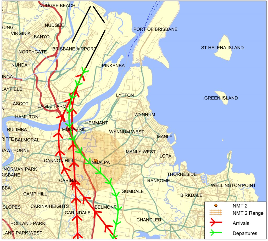
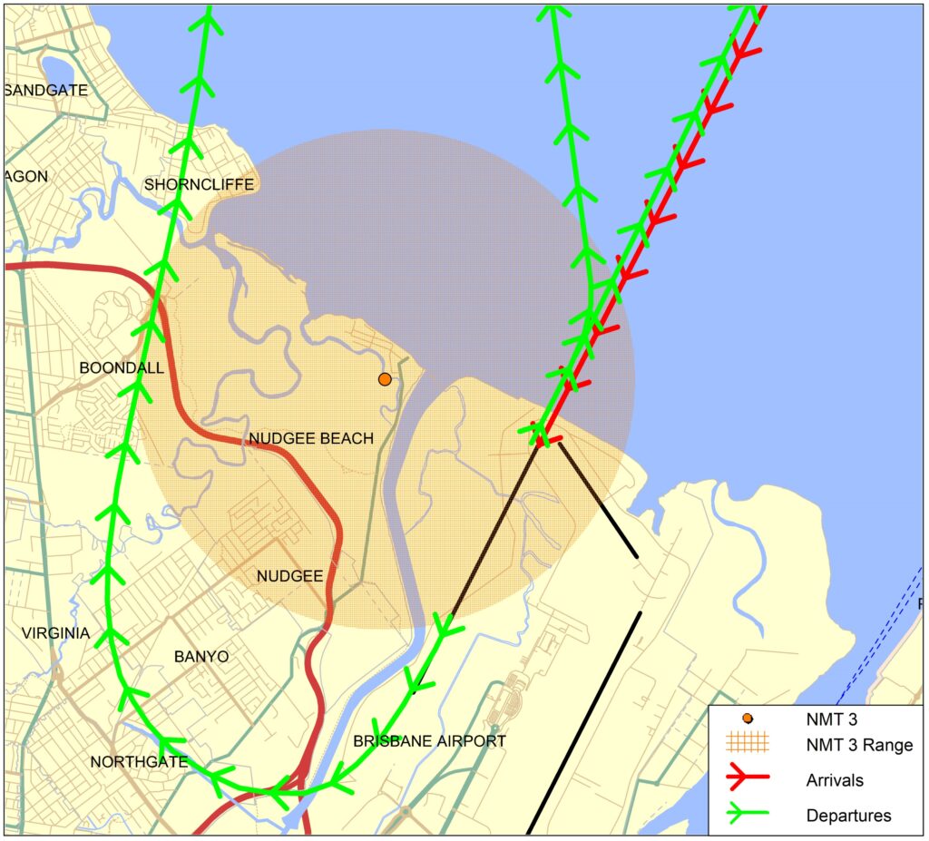
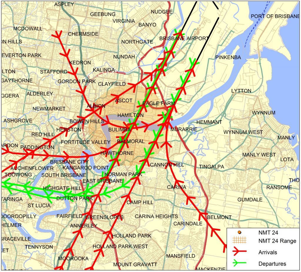
Long term noise monitors are listed below according to their location.
Access monthly data on our Brisbane noise monitoring reports page.
Captures departures from Runway 19L to the south and arrivals to Runway 01R from the south.
Captures departures from Runway 01L/19R to the north and arrivals to Runway 19R from the north.
Captures arrivals to Runway 01L and 01R and departures to the north from Brisbane Runway 19L and 19R.
Captures arrivals to Runway 01L and departures from Runway 01R and 19R.
Captures arrivals to Runway 01L and 01R and departures to the north from Brisbane Runway 19L and 19R.
Captures arrivals to Runway 01L and 01R and departures from Runway 19L and 19R.
Captures arrivals to Runway 01L and 01R, including ILS approaches.
Due to proximity to Archerfield Airport, some aircraft from Archerfield Airport which operate to the north-east of the airport will also be captured.
Captures arrivals to Runway 01L and departures from Runway 19L and 19R.
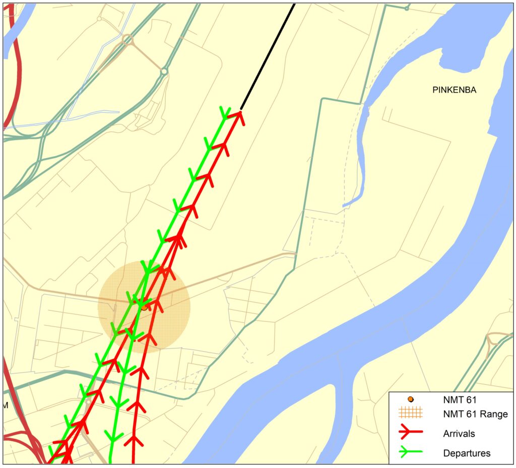
Captures arrivals to Runway 01R and departures from Runway 19L.
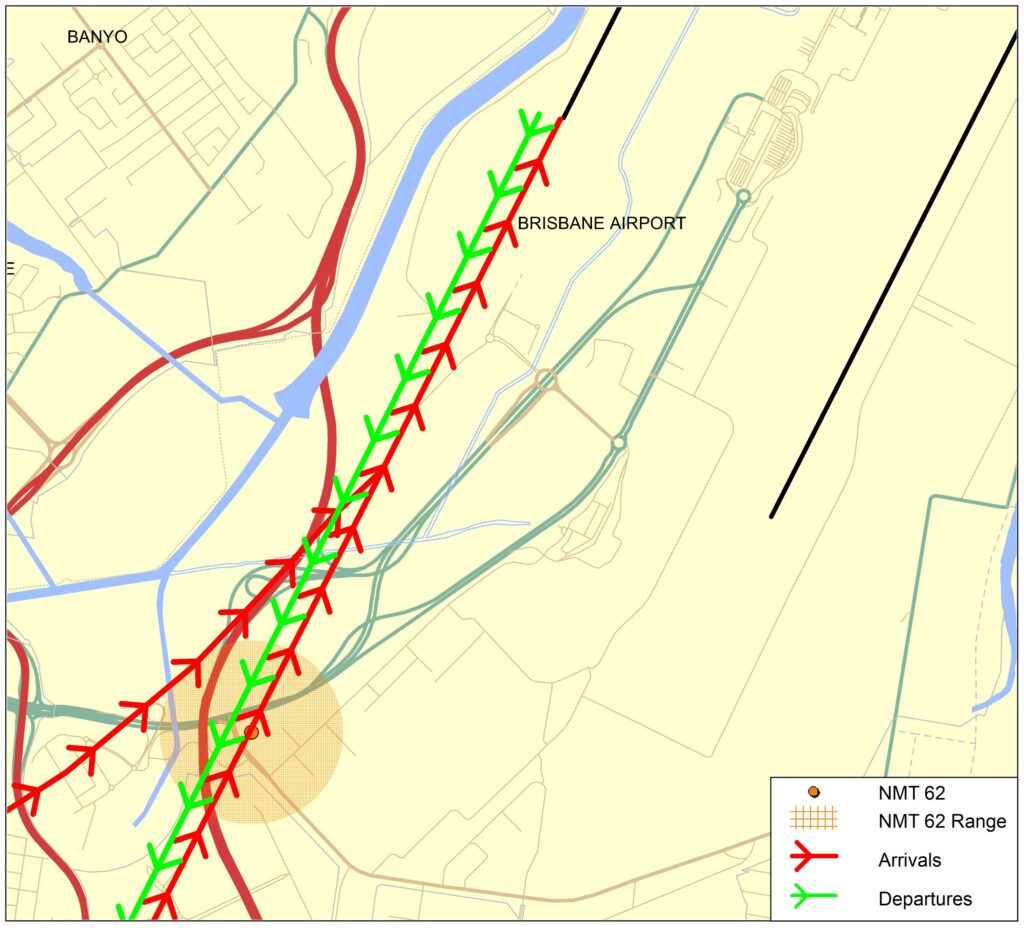
Captures arrivals to Runway 01L and departures from Runway 19R.
Learn more about monitoring aircraft noise on the Airservices website.
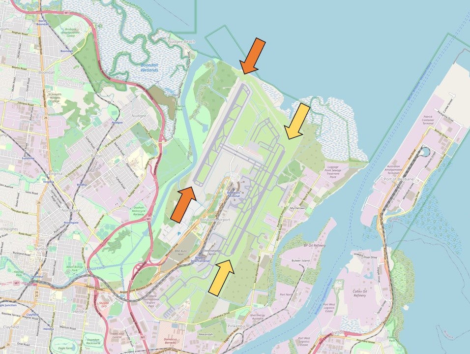
Brisbane Airport has two parallel runways oriented North-South – Runway 01R/19L (existing/legacy), and Runway 01L/19R (new) which opened on 12 July 2020. Both runways are shown in the image below with orange and yellow arrows at either end.
The image below shows the runways, with:
A cross runway (14/32) was de-commissioned as part of the construction of the new runway.
Each runway is referred to differently according to in which direction it is being used, as explained in the following video.
When Brisbane airport is operating in a northerly direction runways 01R and 01L are in use, and runways 19L and 19R are used when the airport is in a southerly direction.
Runway numbering reflects the runways’ orientation and correlates with degrees on a compass. Runway 19 is at 190 degrees.
Operations are divided into two time periods. The day period is 6am to 10pm and the night period is 10pm to 6am.
During the day period, the runway used is based on the planned route of the aircraft. Aircraft planning a route through the north or the west use the new runway, and through the east or the south, the legacy runway.
At night aircraft will when possible operate over Moreton Bay. Arrivals use one runway and departures the other. As the overnight traffic volume is light, aircraft can more readily operate in the same airspace.
Runway selection is based on wind direction, weather conditions, traffic volume and other factors. Aircraft primarily take-off and land into the wind for safety and performance reasons. Therefore, as the wind direction changes the runway in operation may also change depending on the strength of the wind.
Australia’s Civil Aviation Safety Authority (CASA) sets the rules for the provision of Air Traffic Control services. These rules include criteria applying to air traffic control for nominating the runway direction.
If a runway surface is dry, it should not be nominated for use if the downwind exceeds 5 knots. Downwind is wind that blows towards the tail of the aircraft. If the runway surface is wet, it should not be nominated if there is any downwind. For this reason the runway that is nominated for use will usually have a headwind, or if there is downwind, it will be below the criteria.
Learn more about seasonal changes in your area on our How seasonal variation affects your area page.
Use this interactive tool to explore detailed data for your area in the month of your choice.
This report is best viewed in full screen mode.
Common questions that are asked in the Sydney Area:
The flight paths and airspace design for Western Sydney International (Nancy-Bird Walton) Airport is being led by the Western Sydney Unit at the Department of Infrastructure, Transport, Regional Development and Communications.
Further information on the airport and flight paths can be found on the Western Sydney Airport website.
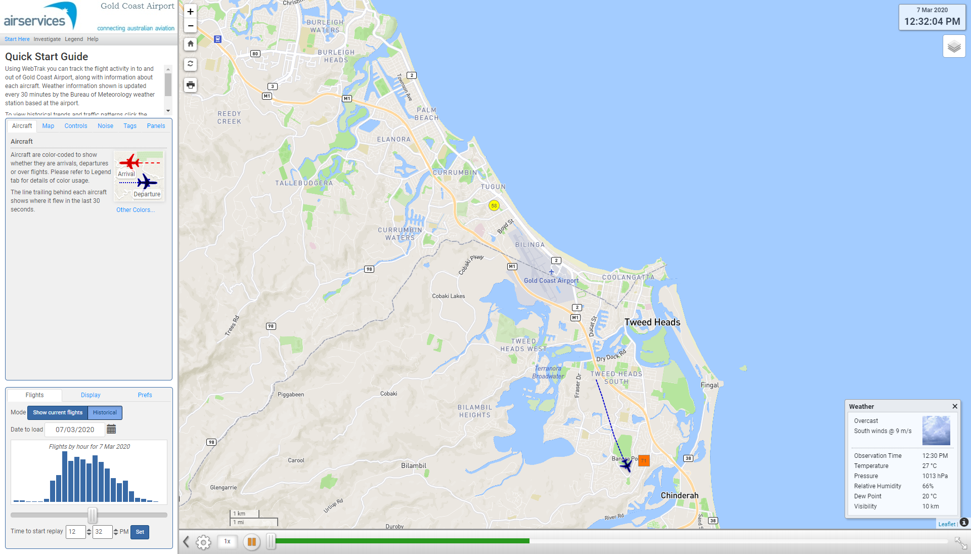
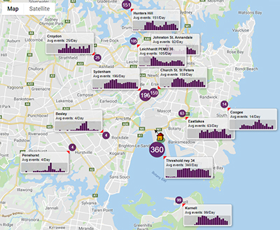
WebTrak My Neighbourhood (left) is an extension of WebTrak that presents historical information about aircraft noise and flight path use to provide an understanding of patterns over time.
Using this tool you can explore arrival, departure or both types of flight paths by month, quarter or year to see:
Access information about how to use WebTrak My Neighbourhood, including a downloadable guide
Visit WebTrak My Neighbourhood – Gold Coast
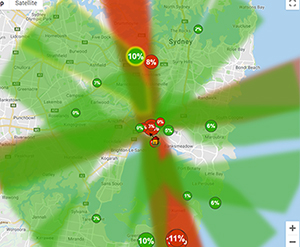
Below: a departure flight path ‘swathe’ with tag showing percentage of departure traffic, number of flights and hours of respite for that flight path in the selected timeframe
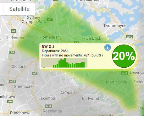
Below: Click the “i” on any flight path tag to see more detailed data
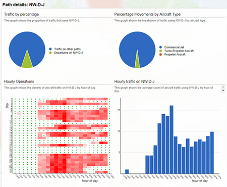
Below: noise monitoring data tags
Powered by: 