Sunshine Coast Airport circuits

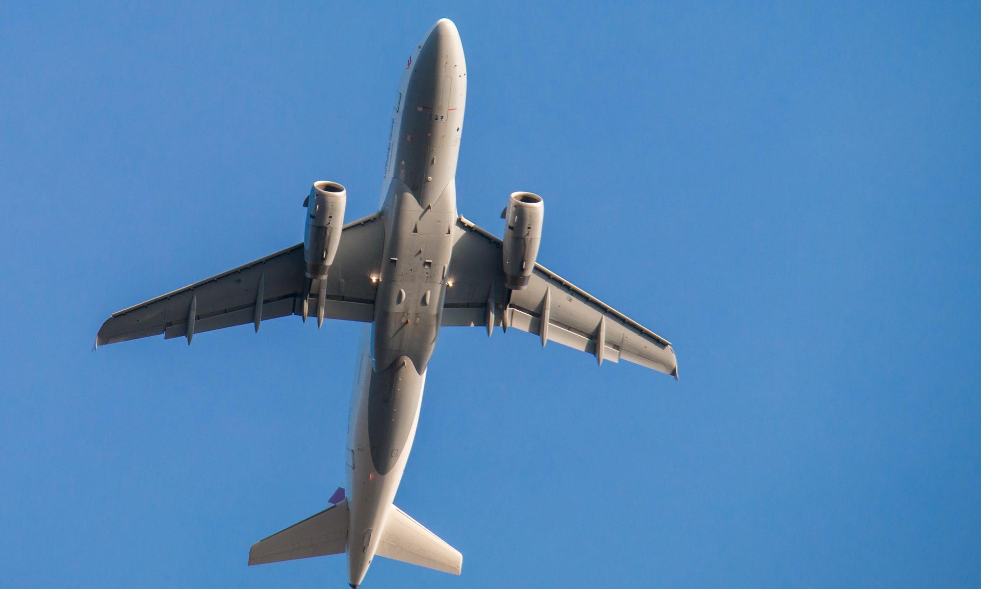
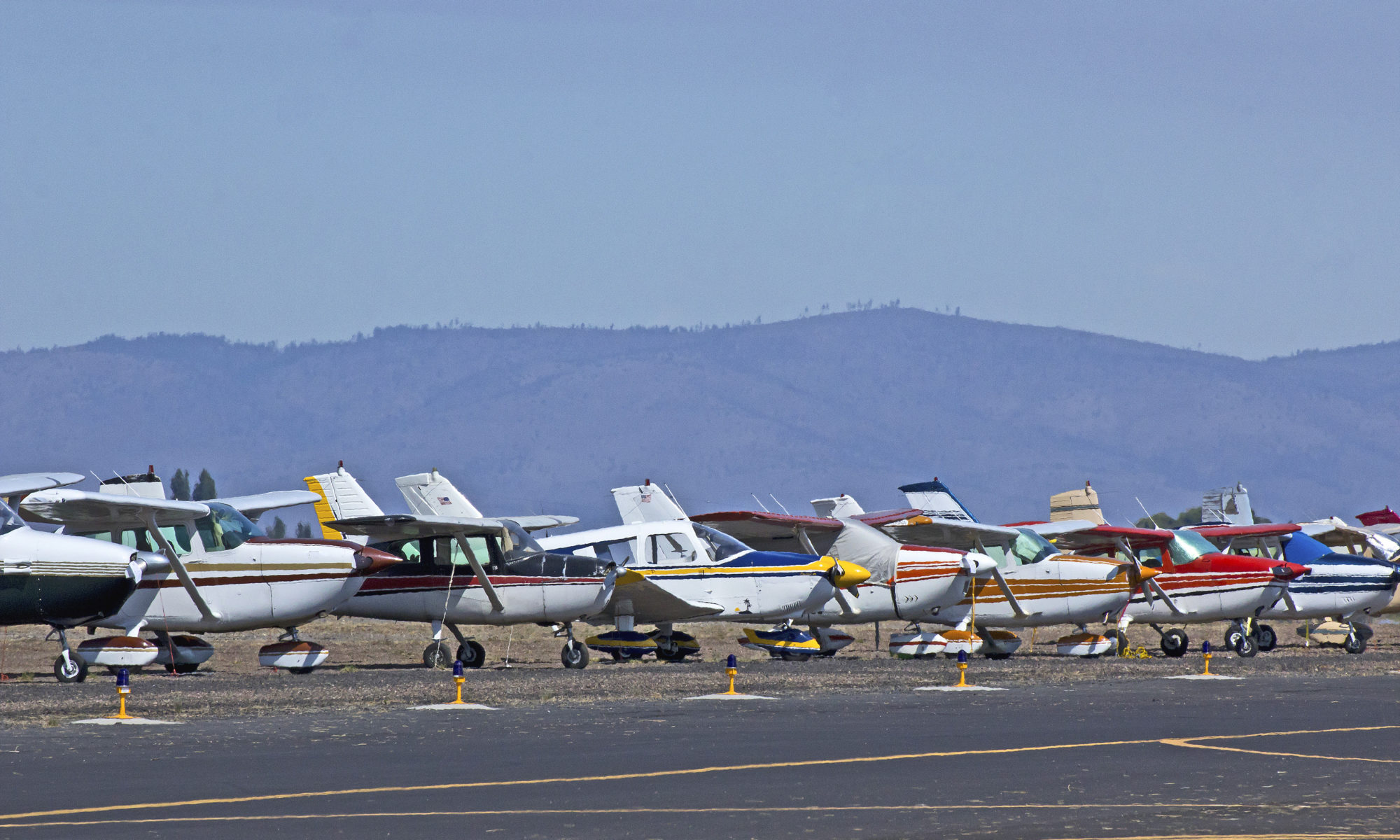
General Aviation (light aircraft and helicopter) operations are conducted to and from Sunshine Coast Airport and aircraft also use the airport for circuit training exercises.

Sunshine Coast Airport aims to limit general aviation activity and circuit training to between 7.00 am and 10.00 pm (unless in the event of an emergency or night time pilot training) to reduce noise during the early morning and night.

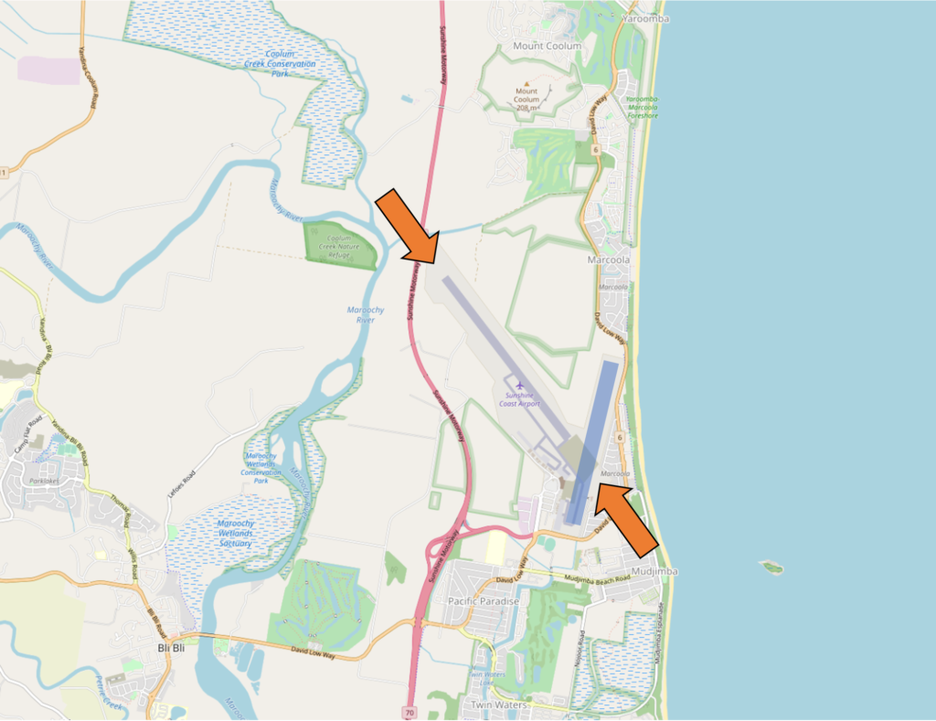
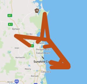
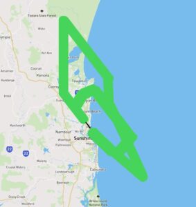
Where are the circuits at Sunshine Coast?

Due to the height of Mount Coolum to the north, aircraft will usually circuit on the south side of the runway near Mudjimba, Twin Waters and Pacific Paradise.

When the air traffic control tower is open, controllers may direct some aircraft to circuit on the north side of the runway (near Marcoola) for traffic management reasons.

Circuit training at Sunshine Coast Airport – June to October 2020

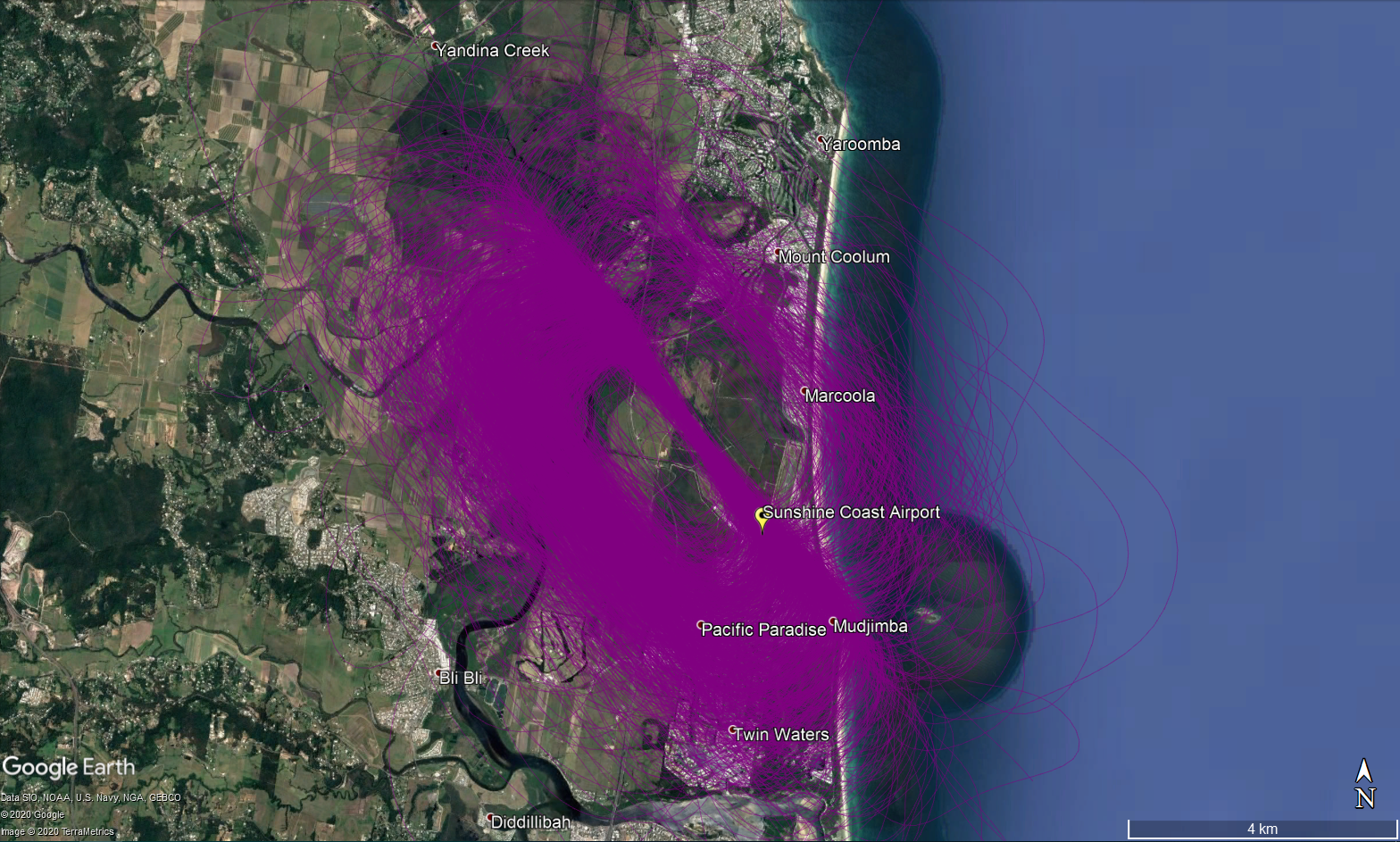
Click on the image above to open a larger view in a new tab.

What is circuit training?

Circuit training is the first stage of practical pilot training focused on take-offs and landings. It involves the pilot making approaches to the runway or helipad, touching down and then applying power to take off again. This is undertaken in accordance with Civil Aviation Safety Authority (CASA) Regulations which are consistent with international practices.

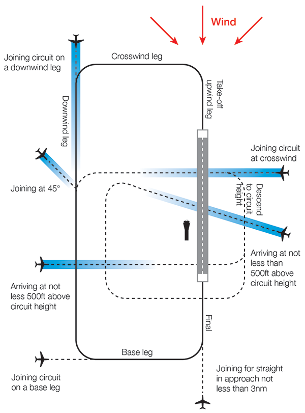
How are circuits flown?

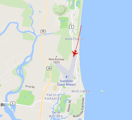
A training circuit consists of five legs – take-off, crosswind, downwind, base and final approach to the runway.

Aircraft take off into the wind, climb to 500 feet and then turn onto the crosswind leg. They continue to ascend to 1000 feet and turn onto the downwind leg. Having turned onto the base leg the descent commences. After turning onto the final leg and lining up with the runway the aircraft will touch down and take off again.

For left-hand circuits, the pilot turns left after take-off and flies anticlockwise. For right-hand circuits, the pilot turns right and flies in a clockwise direction.

A simplified representation of a left-hand circuit is shown above

Learn more about current GA operations on our Impact of COVID-19 on aircraft operations at Sunshine Coast Airport page.

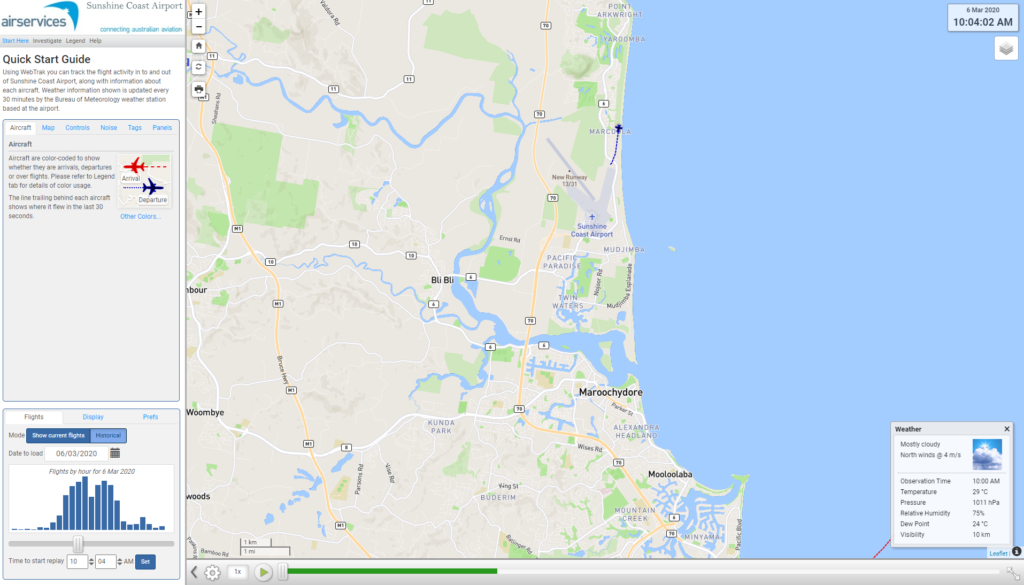
Note: All tracks during the stated period have been displayed. Track colours have been adjusted to show track density. Where aircraft are more concentrated the colour will appear darker.

Sunshine Coast Airport Community Forum

Federally-leased airports (excluding Mt. Isa and Tennant Creek) have established Community Aviation Consultation Groups (CACGs), which provide an effective avenue for local community engagement on airport planning and operations, including aircraft noise. The Department for Infrastructure, Transport, Regional Development and Communications provides guidelines for CACGs.

Non federally-leased airports may also choose to establish CACGs or community forums.

CACG membership depends on the characteristics of the airport and any local issues of community concern however, generally includes:

  • airport management
  • aircraft operators
  • community organisations or representatives
  • representatives from state, territory or local government bodies
  • local tourism and business groups.

Airservices does not formally belong to CACGs, but is invited to attend to provide relevant information and assist in discussions. We engage with CACGs on flight path and airspace changes, as well as technical reviews, such as noise monitoring and noise abatement procedures.

Find out more information on the Sunshine Coast Airport Community and Aviation Forum webpage.

Sunshine Coast Airport Runway

Sunshine Coast Airport has one runway oriented North-West to South-East (Runway 13/31) which opened on 14 June 2020. The runway is shown in the image below with orange arrows at either end.

Each runway is referred to differently according to in which direction it is being used, as explained in the following video.

For example, the runway is referred to as Runway 13 when used in a south-easterly direction and Runway 31 when used in a north-westerly direction.

Runway numbering reflects the runways’ orientation and correlates with degrees on a compass. Runway 13 is at 130 degrees and Runway 31 is at 310 degrees.

The existing north-south runway (RWY 18/36) was de-commissioned when the new runway opened. The old runway is also shown in the image below in blue.


Learn more about seasonal changes in your area on our How seasonal variation affects your area page.

Sunshine Coast Airport NAP 2: Preferred Flight Paths

The NAP lists the preferred flight paths as:

2.1 Preferred Flight Paths

All arriving and departing aircraft to track via a SID and STAR for aircraft above 5,700kg.

Arrivals (STAR)

Departures (SID)

Adherence with this procedure is reported below.

The report is best viewed in full screen mode.

Note: Due to rounding, percentage values may not sum to exactly 100.0%. Minor discrepancies of up to ±1% are expected and do not indicate any errors in the underlying absolute figures, which remain accurate and unaffected.

What was that flight?

WebTrak is a tool that enables the community to see where aircraft fly and explore historical trends and patterns. WebTrak is provided by Envirosuite .

WebTrak uses information from air traffic control radars to display aircraft movements. The flight search and display function allows you to view aircraft flight activity over metropolitan areas. You can also:

  • locate your street address and have your home appear on the map
  • see noise levels of individual aircraft
  • view information about aircraft type, height, origin and destination
  • display an aircraft’s flight path and point of closest approach to your home
  • zoom in and out down to street level.

Note that there is a slight delay on the display of flights.

You can view WebTrak for your region here.

Or, find out more information about WebTrak and how to use it

How many aircraft fly near me?

This tool shows the number of flights each day over your area in the selected month compared to the average for last year.  The bottom axis shows the day of the month. Use the drop-down menu to change the selected month to see how movements have varied. Hover over each day to see flight numbers.

How frequent are flights in my area?

There are a number of factors that influence the frequency of flights.

Firstly, the number and frequency of flights will vary on a daily, weekly and yearly basis due to differences in airline schedules. The airlines schedule flights in response to consumer demand. This is particularly the case around Christmas, Easter, school holidays and Lunar New Year.

Secondly, the runway in use at any given time will also vary, largely due to the wind conditions. Each runway has its own set of flight paths, and each flight path will affect different areas. As the runway in use changes, the flight paths change, and so too do the areas affected by aircraft movements.

This chart shows the total number of flights each hour over the month, compared to the average for last year. Change the selected month to see how it has varied.

How high are aircraft near me?

The altitudes of aircraft over your area can vary according to:

  • the airport the flight is coming from or going to
  • whether the aircraft is arriving, departing or in level flight
  • the specific requirements of the flight path
  • the need for air traffic control to maintain vertical separation between aircraft.

Find out more on our What are the rules about altitudes? page.

Explore detailed data for your area

Use this interactive tool to explore detailed data for your area in the month of your choice.

This report is best viewed in full screen mode.

Sunshine Coast flight paths

New flight paths commenced at Sunshine Coast Airport on 14 June 2020. To learn more about the runways at Sunshine Coast Airport, take a look at our Sunshine Coast Airport Runways page.

The illustration below shows how jet and non-jet (turbo-prop) aircraft typically operate at Sunshine Coast Airport on the published instrument arrival and departure flight paths

The animation is indicative only and provided for information purposes, on occasions flights may leave these general areas from time-to-time.