How frequent are flights in my area?

There are a number of factors that influence the frequency of flights.

Firstly, the number and frequency of flights will vary on a daily, weekly and yearly basis due to differences in airline schedules. The airlines schedule flights in response to consumer demand. This is particularly the case around Christmas, Easter, school holidays and Lunar New Year.

Secondly, the runway in use at any given time will also vary, largely due to the wind conditions. Each runway has its own set of flight paths, and each flight path will affect different areas. As the runway in use changes, the flight paths change, and so too do the areas affected by aircraft movements.

This chart shows the total number of flights each hour over the month, compared to the average for last year. Change the selected month to see how it has varied.

*Please note due to technical issues between 19 June and 22 June 2024, flight data may not be accurately displayed. Our supplier is working to resolve the issue. We apologise for any inconvenience this may cause.

How high are aircraft near me?

The altitudes of aircraft over your area can vary according to:

  • the airport the flight is coming from or going to
  • whether the aircraft is arriving, departing or in level flight
  • the specific requirements of the flight path
  • the need for air traffic control to maintain vertical separation between aircraft.

Find out more on our What are the rules about altitudes? page.

*Please note due to technical issues between 19 June and 22 June 2024, flight data may not be accurately displayed. Our supplier is working to resolve the issue. We apologise for any inconvenience this may cause.

Airport community aviation consultation group

Federally-leased airports (excluding Mt. Isa and Tennant Creek) have established Community Aviation Consultation Groups (CACGs), which provide an effective avenue for local community engagement on airport planning and operations, including aircraft noise. The Department for Infrastructure, Transport, Regional Development and Communications provides guidelines for CACGs.

Non federally-leased airports may also choose to establish CACGs or community forums.

CACG membership depends on the characteristics of the airport and any local issues of community concern however, generally includes:

  • airport management
  • aircraft operators
  • community organisations or representatives
  • representatives from state, territory or local government bodies
  • local tourism and business groups.

Airservices does not formally belong to CACGs, but is invited to attend to provide relevant information and assist in discussions. We engage with CACGs on flight path and airspace changes, as well as technical reviews, such as noise monitoring and noise abatement procedures.

Find out more information on the

Melbourne Airport Community Aviation Consultation Group webpage

Essendon Airport Community Aviation Consultation Group webpage

Moorabbin Airport Community Aviation Consultation Group webpage.

The Melbourne Noise and Flight Path Monitoring System (NFPMS)

We collect noise and operational data from five noise monitors (Environmental Monitoring Unit, EMU) around Melbourne Airport. Noise monitors are listed below according to their location.

Access monthly data on our Melbourne noise monitoring reports page.

BULLA (EMU 2)

Captures arrivals to Melbourne Runway 16 and departures from Melbourne Runway 34.

Detects more events than the other noise monitor locations due to its proximity to the airport.
The pattern of aircraft noise events recorded reflects the seasonal trends in arrivals to Runway 16, with more events recorded in summer than in winter.

ESSENDON (EMU 4)

Captures arrivals to Melbourne Runway 34 and arrivals to Essendon Runway 35 and departures off Essendon Runway 17.

Seasonal fluctuations in the use of Runway 34 at Melbourne Airport are offset by the opposite fluctuations in the use of Runway 17 at Essendon Airport.

COOLAROO (EMU 6)

Captures arrivals to Melbourne Runway 27.

While the pattern of noise events recorded reflects the seasonal trend for arrivals to Runway 27 the correlation is not precise as there are some parts of the year where for noise abatement purposes, Runway 27 is used more for departures than for arrivals. Departures from Runway 27 do not fly over this monitor.

KEILOR DOWNS (EMU 9)

Captures arrivals to Melbourne Runway 34 and Melbourne Runway 27 and departures off Melbourne Runway 16.

KEILOR EAST (EMU 3)

Captures arrivals to Melbourne Runway 34 and arrivals to Essendon Runway 08 and departure off Essendon Runway 26.

The pattern of aircraft noise events reflects the seasonal trend for arrivals to Runway 34, with more events recorded in winter than in summer.

THOMASTOWN (EMU 11)

Captures arrivals to Melbourne Runway 27.

The pattern of aircraft noise events recorded reflects the seasonal trend for arrivals to Runway 27, with more events recorded in winter than in summer. As a result the trend for this monitor mirrors that of Coolaroo monitor.

Learn more about monitoring aircraft noise on the Airservices website.

Explore detailed data for your area

Use this interactive tool to explore detailed data for your area in the month of your choice.

This report is best viewed in full screen mode.

*Please note due to technical issues between 19 June and 22 June 2024, flight data may not be accurately displayed. Our supplier is working to resolve the issue. We apologise for any inconvenience this may cause.

Melbourne noise monitoring report

Use this interactive tool to explore monthly noise monitoring data.

This report is best viewed in full screen mode.

To learn more about noise monitor terminal locations visit our Melbourne Noise and Flight Path Monitoring System page.

Investigation: Runway 34 arrivals over Newport (2024)

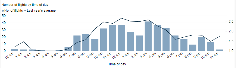
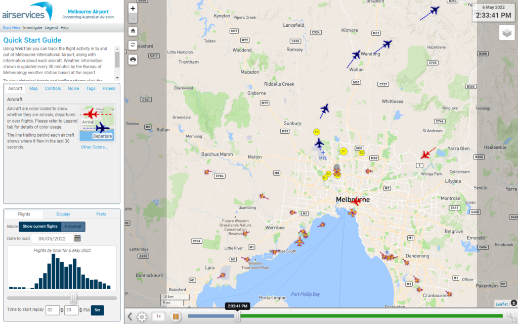
Learn about our investigation into Runway 34 arrivals over Newport into Melbourne Airport

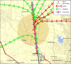
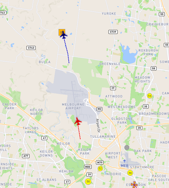
A community proposal was presented to move the arrival flight path for Melbourne Airport Runway 34 (arrivals to the southern end of the north-south runway). Currently arrivals from the western side of the airport fly over the Newport and South Kingsville areas in making a left turn to join the final runway aligned straight-in approach to the runway. The suggestion was to move the left turn earlier so aircraft would fly over industrial areas of Altona North / the M1 before joining the runway aligned segment. This would result in a noise improvement for the Newport and South Kingsville areas.

Upon investigation, the proposal could not be implemented due to the location of Newport and South Kingsville being in alignment with Runway 34. Under precision landing approaches for Melbourne Airport, all aircraft arriving via Runway 34 must track via a waypoint called AKDEL.  A waypoint is a geographical location used to define a point on flight path and is defined by geographic coordinates. Unfortunately Newport/ South Kingsville is located under AKDEL.

AKDEL is in a very specific location based on runway alignment requirements and distance from the runway, in accordance with the International Civil Aviation Organization (ICAO) procedures in flight path design that guide the distances of procedures, specified altitudes and turn angles. The tighter turn suggested cannot be achieved as turns of arrival flight paths are designed to ensure adequate distances for aircraft to be at precise minimum safe altitudes before commencing their descent into the airport following a 3 degree glide slope.

A further suggestion was made to design a second (alternate) flight path for non-heavy aircraft to take the shorter turn, allowing noise to be shared. In assessing flight path changes Airservices considers the efficient operations of the airport and also whether there would be an overall noise improvement for the community. This shorter arrival path from the west would expose suburbs including Sunshine, Saint Albans, Deer Park and Burnside to increased levels of aircraft noise. Airservices does not generally consider that moving noise from one part of the community to another is a noise improvement. Due to reasons outlined above, the proposal was deemed not feasible to proceed.

What was that flight?

WebTrak is a tool that enables the community to see where aircraft fly and explore historical trends and patterns. WebTrak is provided by Envirosuite.

WebTrak uses information from air traffic control radars to display aircraft movements. The flight search and display function allows you to view aircraft flight activity over metropolitan areas. You can also:

  • locate your street address and have your home appear on the map
  • see noise levels of individual aircraft
  • view information about aircraft type, height, origin and destination
  • display an aircraft’s flight path and point of closest approach to your home
  • zoom in and out down to street level.

Note that there is a slight delay on the display of flights.

You can view WebTrak for your region here.

Or, find out more information about WebTrak and how to use it

Noise Complaints and Information Service Report

We manage complaints and enquiries about aircraft noise and operations through our Noise Complaints and Information Service (NCIS). The information below is collected for the purpose of complaint management, analysis of issues and identification of causal factors.

For this reason we refer to ‘complainants’ and ‘issues’. Complainants are people who contacted us. While some people submitted enquiries or comments rather than complaints, all are referred to as “complainants”. Issues are the primary concern they raised.

The complaints report

Use this interactive tool to explore the issues raised by residents from different suburbs. For help, click the button in the bottom right-hand corner.

This report is best viewed in full screen mode.

Read an explanation of issues and classifications used in complaint reporting.


Investigation: Runway 16 departures over St Albans and Ardeer

Airservices explored the possibility of moving further south the point at which aircraft turn west after departure from Runway 16. After making this turn aircraft pass over St Albans. The investigation found that this was not feasible for two reasons. While it would result in benefits for Ardeer and St Albans, it would move the traffic and noise to Sunshine. In addition, aircraft would remain on the runway heading for longer and this would hamper efficient operations. The current procedure allows air traffic control to clear the next aircraft for take-off after the previous one has made the turn. If aircraft maintain the runway heading for longer, this means that more time must elapse before the aircraft behind can take off which would slow down the throughput of aircraft. The proposal was found to be unfeasible because it was not considered to be a noise improvement overall and for efficiency reasons.