Impact of COVID-19 on aircraft operations at Sunshine Coast Airport

Scheduled aircraft movement numbers

Due to the impacts of COVID-19 there was an overall decrease in scheduled flight operations (typically jet and turbo-prop aircraft) at Sunshine Coast Airport.

A comparison with the most recent available monthly figures show that passenger aircraft movements decreased by nearly 93%, from 810 movements in September 2019 to 58 movements in September 2020 (Source: BITRE.gov.au).

Aircraft destinations

Due to COVID-19 travel restrictions and border closures most of the operations at Sunshine Coast Airport have been intrastate (within Queensland and therefore mainly flying north) and operated by regional carriers who fly smaller aircraft (such as turbo-propeller aircraft).

During the pandemic the new runway opened and as the new runway is orientated differently to the old runway, this has changed the overall direction of arriving and departing flights.

For more information on the runway orientation and naming visit our Sunshine Coast Airport Runway page.

Arrivals

Combined jet and turbo-prop arrivals to old runway (blue) – November 2019

The image above shows pre-COVID levels of scheduled aircraft arrivals.

Combined jet and turbo-prop arrivals to new runway (blue) – November 2020

The image above shows an overall reduction in levels of aircraft arrivals, with a change in the flight paths used due to the re-oriented runway.

Click on the images above to open a larger view in a new tab.

Departures

Combined jet and turbo-prop departures from old runway (green) – November 2019

The image above shows pre-COVID levels of scheduled aircraft departures.

Combined jet and turbo-prop departures from new runway (green) – November 2020

The image above shows an overall reduction in levels of aircraft departures, with a change in the flight paths used due to the re-oriented runway.

Click on the images above to open a larger view in a new tab.

General Aviation (GA) Operations

As a result of COVID-19 there was an overall increase in GA operations at Sunshine Coast Airport.

The large reduction in scheduled flight operations meant that there were increased GA training opportunities and more pilots were flying using Visual Flight Rules (VFR) for recreational and commercial purposes.

While the number of GA operations increased, they continued to operate in similar locations. This is because the majority of small sized aircraft fly VFR, where instead of using published flight paths the pilot flies using visual reference to prominent ground features.

Arrivals

General Aviation arrivals to the old runway – November 2019

The image above shows pre-COVID GA activity and locations aircraft commonly operated in.

General Aviation arrivals to the new runway – November 2020

The image above shows an overall increase in GA activity but a similar pattern in the locations aircraft fly.

Click on the images above to open a larger view in a new tab.

Departures

General Aviation departures to the old runway – November 2019

The image above shows pre-COVID GA activity and locations aircraft commonly operate in.

General Aviation departures to the new runway – November 2020

The image above shows an overall increase in GA activity but a similar pattern in the locations aircraft fly.

Click on the images above to open a larger view in a new tab.

Learn more about GA circuit training operations on our Sunshine Coast Airport Circuits page.

Return to normal operations

These traffic patterns are in a regular state of flux due to the impacts of COVID-19 on the aviation industry.

We do not expect to see a stable, representative traffic pattern for Sunshine Coast until at least early 2021 (subject to airline schedules).

As travel restrictions lift, we expect there will be an increase in scheduled passenger flights and decrease in general aviation operations.


Note: All tracks during the stated month have been displayed. Track colours have been adjusted to show track density. Where aircraft are more concentrated the colour will appear darker.

How seasonal variation affects your area

Aircraft usually take-off and land into the wind for safety and performance reasons. As the wind direction changes the runway in operation and the flight paths being used may also change.

This means that the Sunshine Coasts seasonal wind patterns affect usage of the different runway directions.

When there are easterly or southerly winds, aircraft approach the runway from an inland direction and depart towards the ocean.

When the wind is from a westerly or northerly direction, the runway is used in the opposite direction.

If the wind is light or calm the direction the runway is used is determined by other factors such as Noise Abatement Procedures (NAP) or air traffic management requirements.

As we gather more data on operations we will update this section with more information.


Learn more about how the runway is named and oriented on our Sunshine Coast Airport Runway page.

Sunshine Coast Airport circuits

General Aviation (light aircraft and helicopter) operations are conducted to and from Sunshine Coast Airport and aircraft also use the airport for circuit training exercises.

Sunshine Coast Airport aims to limit general aviation activity and circuit training to between 7.00 am and 10.00 pm (unless in the event of an emergency or night time pilot training) to reduce noise during the early morning and night.

Where are the circuits at Sunshine Coast?

Due to the height of Mount Coolum to the north, aircraft will usually circuit on the south side of the runway near Mudjimba, Twin Waters and Pacific Paradise.

When the air traffic control tower is open, controllers may direct some aircraft to circuit on the north side of the runway (near Marcoola) for traffic management reasons.
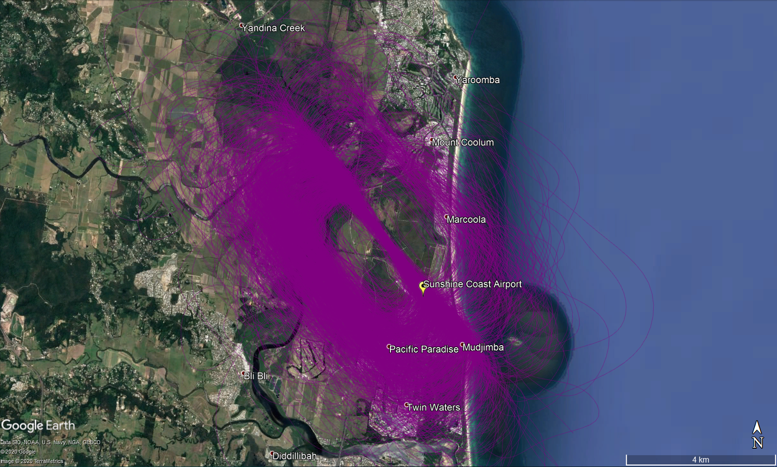
Circuit training at Sunshine Coast Airport – June to October 2020

Click on the image above to open a larger view in a new tab.

What is circuit training?

Circuit training is the first stage of practical pilot training focused on take-offs and landings. It involves the pilot making approaches to the runway or helipad, touching down and then applying power to take off again. This is undertaken in accordance with Civil Aviation Safety Authority (CASA) Regulations which are consistent with international practices.

How are circuits flown?

A training circuit consists of five legs – take-off, crosswind, downwind, base and final approach to the runway.

Aircraft take off into the wind, climb to 500 feet and then turn onto the crosswind leg. They continue to ascend to 1000 feet and turn onto the downwind leg. Having turned onto the base leg the descent commences. After turning onto the final leg and lining up with the runway the aircraft will touch down and take off again.

For left-hand circuits, the pilot turns left after take-off and flies anticlockwise. For right-hand circuits, the pilot turns right and flies in a clockwise direction.
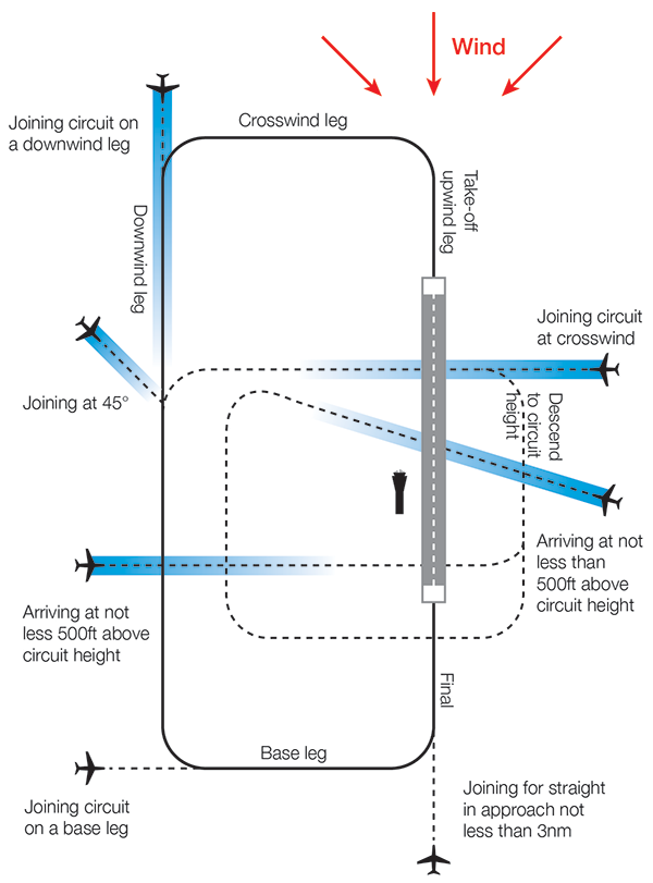
A simplified representation of a left-hand circuit is shown above

Learn more about current GA operations on our Impact of COVID-19 on aircraft operations at Sunshine Coast Airport page.

Note: All tracks during the stated period have been displayed. Track colours have been adjusted to show track density. Where aircraft are more concentrated the colour will appear darker.

What was that flight?

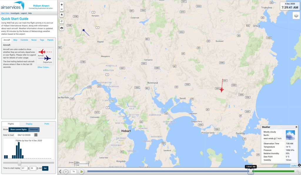
WebTrak is a tool that enables the community to see where aircraft fly and explore historical trends and patterns. WebTrak is provided by Envirosuite.

WebTrak uses information from air traffic control radars to display aircraft movements. The flight search and display function allows you to view aircraft flight activity over metropolitan areas. You can also:

  • locate your street address and have your home appear on the map
  • see noise levels of individual aircraft
  • view information about aircraft type, height, origin and destination
  • display an aircraft’s flight path and point of closest approach to your home
  • zoom in and out down to street level.

Note that there is a slight minute delay on the display of flights.

You can view WebTrak for your region here.

Or, find out more information about WebTrak and how to use it.

Cambridge Airport Flight Paths

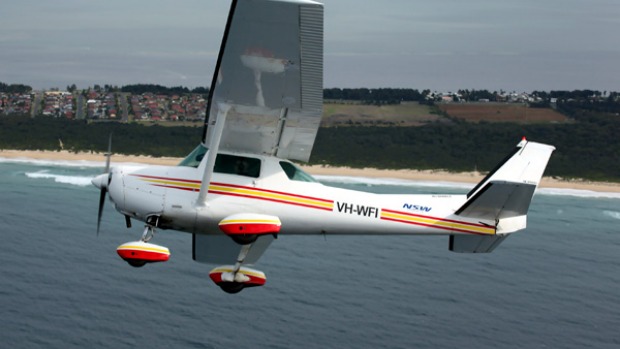
Cambridge Airport has a range of General Aviation (light aircraft) operations.

To learn more about Cambridge Airport operations, take a look at our Cambridge Airport circuits page.

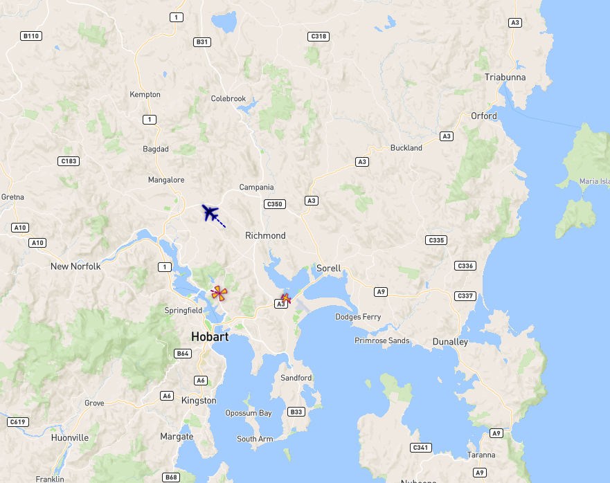
The illustration below shows how light aircraft typically operate at Cambridge Airport. These aircraft usually fly using visual flight rules, where the pilot uses visual references to the ground or water rather than flying on a published instrument flight path. This means we see a broad area where light aircraft may fly.

The animation is indicative only and provided for information purposes, on occasions flights may leave these general areas from time-to-time.

Will flights increase in the future in my area?

Flight Path and Airspace Changes

Visit Engage Airservices to engage with our program of flight path and airspace changes.

Hobart Airspace Design Review – Post Implementation Review

On 7 November 2019, Airservices introduced new instrument flight procedures and flight paths at Hobart Airport. As these flight paths have been in operation for over 12 months, we have commenced a Post Implementation Review (PIR) and are accepting community suggested alternatives for flight paths and Noise Abatement Procedures (NAPS).

For more information, including how to participate in the Review visit Engage Airservices.

Airport Master Plans

Airport Master Plans provide a blueprint for the future development of an airport over a twenty year period. They include information on forecast growth, airport terminals and facilities, runways and flight paths.

Who is responsible for master planning?

Airports are responsible for producing the master plan.

Hobart Airport

The Hobart Airport Master Plan can be found on the Hobart Airport website.