Learn about flight paths and aircraft movements in your area
Welcome to the Aircraft in Your Neighborhood Portal
Our goal is that you will learn more about the flight paths and aircraft movements in your area and be able to access the information and resources that explain how air traffic is managed.
First, please select your location using one of the following options, so that we can customize the information for your location.
We’ll remember your location so you don’t have to enter it every time you visit the site and we’ll keep this information confidential.
Please note, that this site works best on Chrome, Firefox and Edge.
* Mandatory - Select region first to view the map.
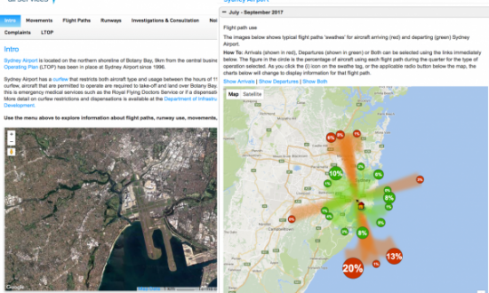
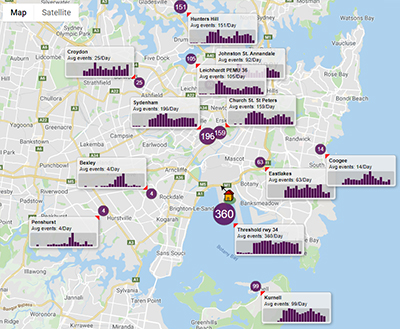
WebTrak My Neighbourhood (left) is an extension of WebTrak that presents historical information about aircraft noise and flight path use to provide an understanding of patterns over time.
Using this tool you can explore arrival, departure or both types of flight paths by month, quarter or year to see:
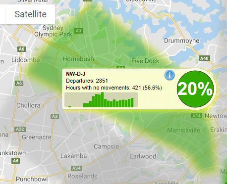
Below: a departure flight path ‘swathe’ with tag showing percentage of departure traffic, number of flights and hours of respite for that flight path in the selected timeframe
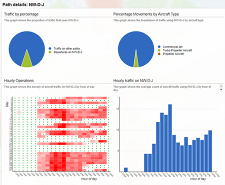
Below: Click the “i” on any flight path tag to see more detailed data
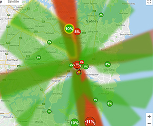
Each runway in use at an airport has its own set of flight paths, and each flight path will affect different areas. As the runway in use changes, the flight paths in use will change, and so too do the suburbs affected by aircraft movements.
The runway in use at any given time and the direction of the traffic flow will vary primarily according to the wind conditions at the airport. This is because aircraft must take off and land into the wind for safety reasons. Generally, this means that in:
Northerly wind conditions at the airport (including north-westerlies and north-easterlies), north flow will be used.
Southerly wind conditions at the airport, including south-westerly and south-easterly conditions, south flow will be used.
However at times a runway direction may be used with a small amount of tailwind as long as it does not exceed the Civil Aviation Safety Authority’s limits for downwind (tailwind) and crosswind.
When the wind at the airport is calm or light, other factors are taken into account in selecting the runway that will be used. For example, the location of the terminals and the positioning of the taxiways can influence the decision.
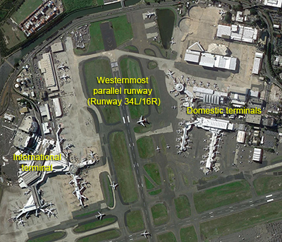
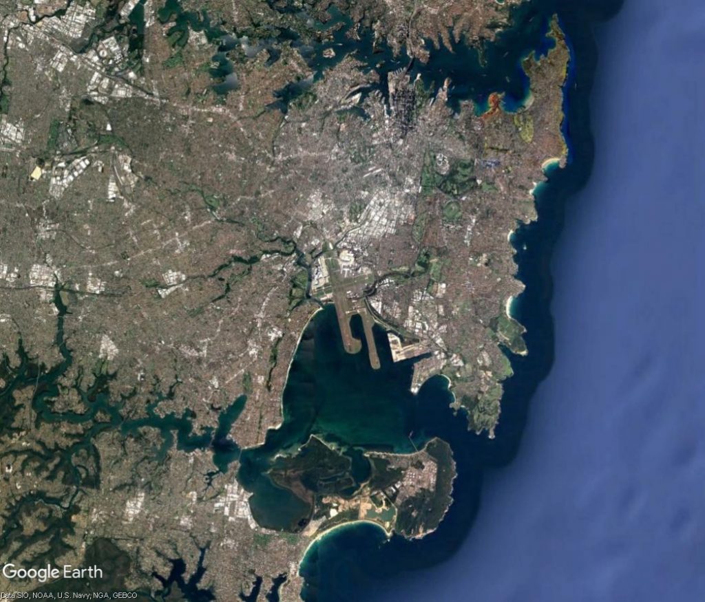
At Sydney Airport, the proximity of the terminals to the northern end of the westernmost parallel runway means that in busy periods when south flow is being used, there is not always enough space on the taxiways between the terminals and the runway end for all the waiting aircraft to queue for take-off.
To manage this, some aircraft may need to be held at the departure gate until space becomes available. This can result in delays and create knock-on effects around the country. For this reason, if the wind is not a factor in the decision, north flow will usually be preferred over south flow during peak periods.
The proximity of the terminals to the runway at northern end of Sydney Airport means there is limited space on the taxiways for queuing. Below right: There is much more room for queuing aircraft on the taxiways at the southern end of the Airport.
Our page on Runway Selection discusses how decisions are made about which runway to use.
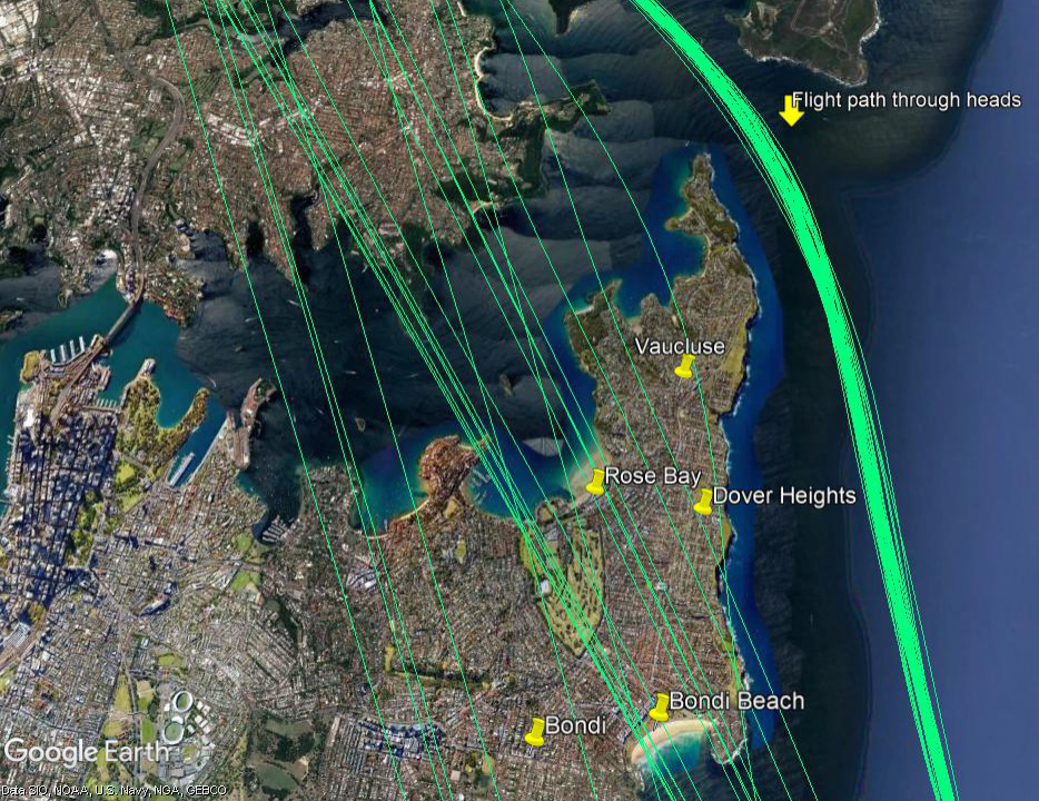
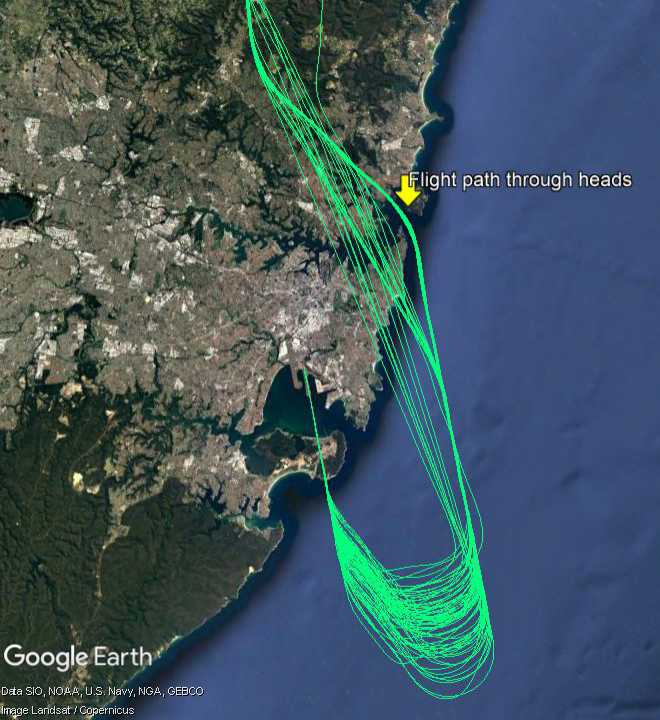
There is a flight path for aircraft arriving into Sydney from northern ports that brings aircraft through the Sydney heads and southwards down the coast, over water, to arrive on the easternmost parallel runway. This flight path is used when the parallel runways are being used in a northerly direction (“north flow”).
There are times when air traffic controllers need to take aircraft off this flight path to ensure they remain safely separated from other traffic and/or can be efficiently sequenced with aircraft arriving from the east, south and west for landing. When there is poor weather, or in peak periods when there is a high volume of traffic in the airspace, this is more likely to occur.
The image at right shows actual tracks of aircraft arriving into Sydney from the north and travelling southwards to land on the easternmost parallel runway.
When aircraft are diverted from the usual flight path they must be directed over land, and will pass over suburbs such as Rose Bay, Dover Heights and Point Piper. It is not possible to divert these aircraft further east, over the water, because this would create potential conflicts with aircraft that are departing from the easternmost parallel runway and heading north-east. The conflicts could occur because the departures and the arrivals would be at similar altitudes when their paths crossed.
The image below is a zoomed in view of the tracks of aircraft arriving from the north. Aircraft on the usual flight path can be seen flying through the heads and down the coast over water. Aircraft that have been taken off the normal flight path can be seen flying over land.
Aircraft taken off the usual flight path will generally be in the altitude range of 6,000 to 8,000 feet as they pass over the eastern suburbs. This is around twice as high as the jet aircraft that depart over the area.
Air traffic controllers are aware of potential noise implications for the community and do not take aircraft off standard routes unless it is operationally necessary. Unfortunately, when operationally required, this cannot be avoided.
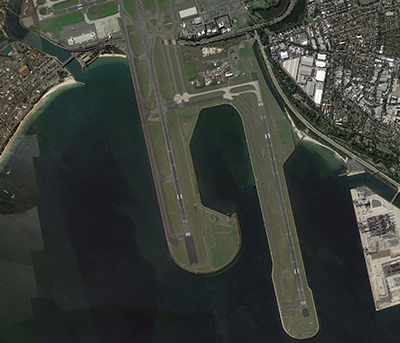
Two parallel runways that are orientated north/south, and
A single crossing runway that runs east/west.
Runways can be used in both directions which results in four flows that are outlined in the illustration below. To learn how the flow direction is determined, visit our When is each flight path used? page.
The animation is indicative only and provided for information purposes, on occasions flights may leave these general areas from time-to-time.
A large expanse of military airspace exists around Richmond RAAF Base in the north-west of Sydney, as shown in the image below. Locations inside and surrounding this area are likely to experience noise from military aircraft operations. This includes activities within the restricted area and aircraft flying in and out of the Base to and from other destinations.
Noise Mitigation
The Department of Defence Aircraft Noise Management Strategy outlines how they work with local communities to reduce noise impacts, while balancing operational and training requirements.
Flying operations are conducted in consideration of local communities, whilst maintaining the safe operation of the aircraft. More information can be found in the:
You can access more information on military aircraft activity at:
As Australia’s air traffic management and aviation rescue fire fighting service provider managing 11% of the world’s airspace, our primary focus is to ensure the safety of air travel both in the air and on the ground at airports.
Each year, millions of people travel to, from and within Australia, with about 3.9 million flights taking off and landing across the country.
Managing air travel—including safety, efficiency, environmental and community impact—is a shared responsibility. Government agencies, airlines and airports work together to balance these priorities.
At Airservices, our highly trained air traffic controllers manage flights at every stage—departure, enroute travel, and arrival—working together to keep planes safe in controlled airspace.
We provide air traffic services at 29 airports, across Australia. Our aviation rescue fire fighters are on standby at 27 airports, ready to respond to emergencies. Most of these airports operate 24/7 without restriction, but some have movement caps and curfews set by the Federal Government to manage local impacts.
At Airservices Australia, we are committed to ensuring safe, efficient, and responsible air travel while balancing the needs of communities and the aviation industry.
Australia’s skies are some of the busiest in the world, with millions of flights taking off and landing every year. At Airservices Australia, we work behind the scenes, safely managing air traffic in controlled airspace while considering noise impacts on communities.