Essendon Airport Flight Paths
There are flight paths in and out of Essendon Airport for Instrument Flight Rules (IFR) aircraft and Visual Flight Rules (VFR) aircraft as explained below.
Because Melbourne Airport and Essendon Airport are in very close proximity, traffic at Essendon Airport sometimes needs to be managed in irregular ways to ensure that separation is maintained with Melbourne Airport traffic. Therefore at times you may observe aircraft flying in unusual ways.
A curfew that restricts both aircraft type and usage between the hours of 11pm and 6am applies. Certain classes of aircraft are permitted to operate during the curfew, including emergency services. More detail on curfew restrictions and dispensations is available on the Department of Infrastructure, Transport, Regional Development and Communications website.
Aircraft operating in Australia are required to meet noise standards imposed through the Air Navigation (Aircraft Noise) Regulations 201
IFR Routes
Arrivals
Aircraft will approach Essendon Airport from all directions before they join the final approach path. Most arriving IFR aircraft will use standard arrival paths but some may be “radar vectored” by Melbourne air traffic control to intercept the final approach, that is, some aircraft may be given individual headings.
During inclement weather aircraft will usually make instrument approaches, which require the aircraft to be aligned with the runway in use 18 kilometres or more out from the airport as can be seen in the image of arrival flight paths below.
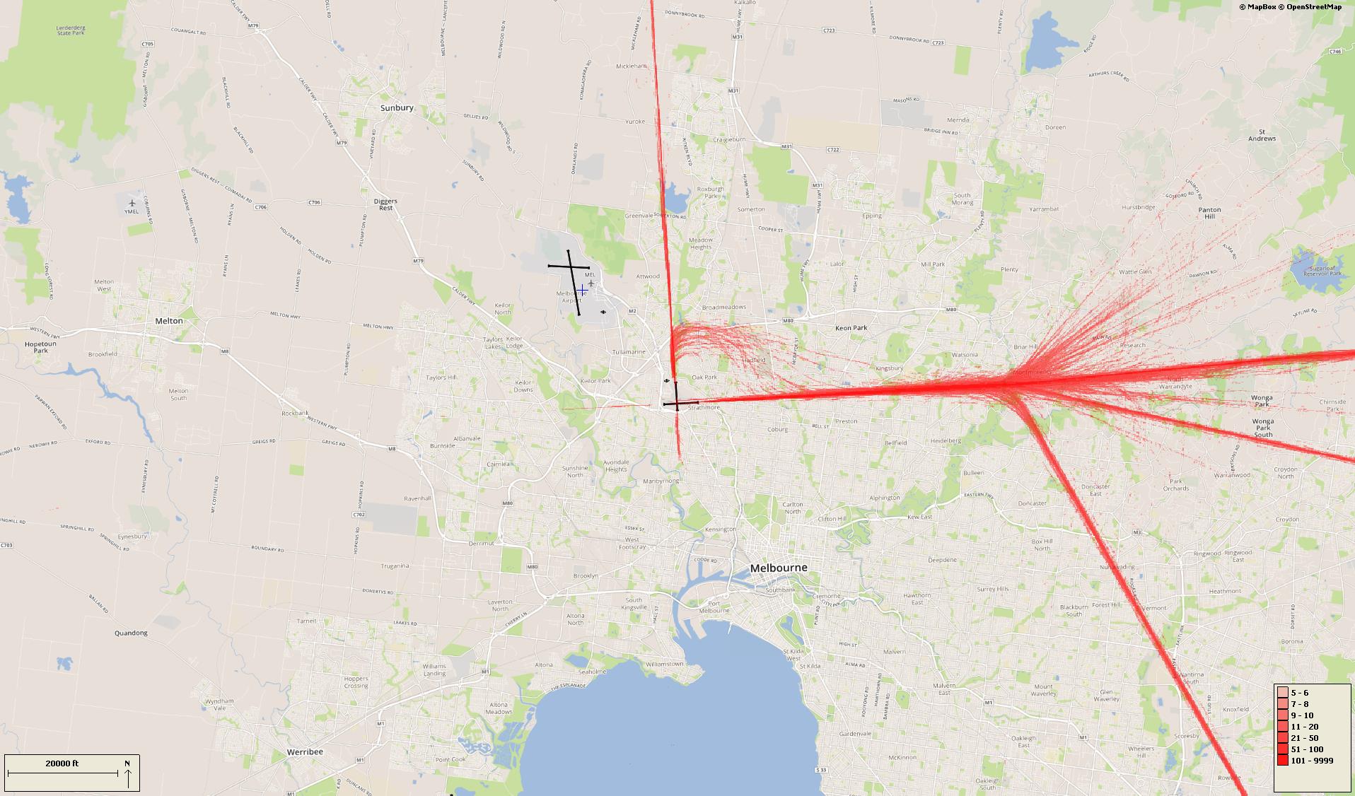
There is no minimum altitude for aircraft in the process of landing. Aircraft will generally descend on a glide slope of three degrees.
Departures
Aircraft departing Essendon Airport must be kept separated from aircraft departing and arriving Melbourne Airport. In most cases Essendon departures will be turned away from Melbourne Airport after take-off. Some aircraft may be directed to turn off the runway heading sooner than others. This usually occurs for traffic management reasons to ensure that safe separation is maintained between aircraft.
The altitude of aircraft after departure will depend on factors such as the type of aircraft and its weight, how heavily laden it is with fuel and passengers, and the atmospheric conditions at the time. All these factors affect an aircraft’s climb rate. There is no regulated minimum altitude for an aircraft in the process of taking off.
VFR routes
There are designated routes for Visual flight Rules (VFR) aircraft to ensure that this traffic remains separate from aircraft flying under Instrument Flight Rules such as jets and most commercial aircraft. It is not mandatory that VFR aircraft fly these routes, but many do, especially as they approach or depart airports.
These routes are mainly outside controlled airspace (“OCTA”), that is, aircraft are not being directed by air traffic control. Whenever they fly outside controlled airspace, pilots are following the rules of the air. More information about airspace is found here.
VFR routes include defined entry and exit points to and from controlled airspace. These are landmarks that are easily seen by the pilot from the air.
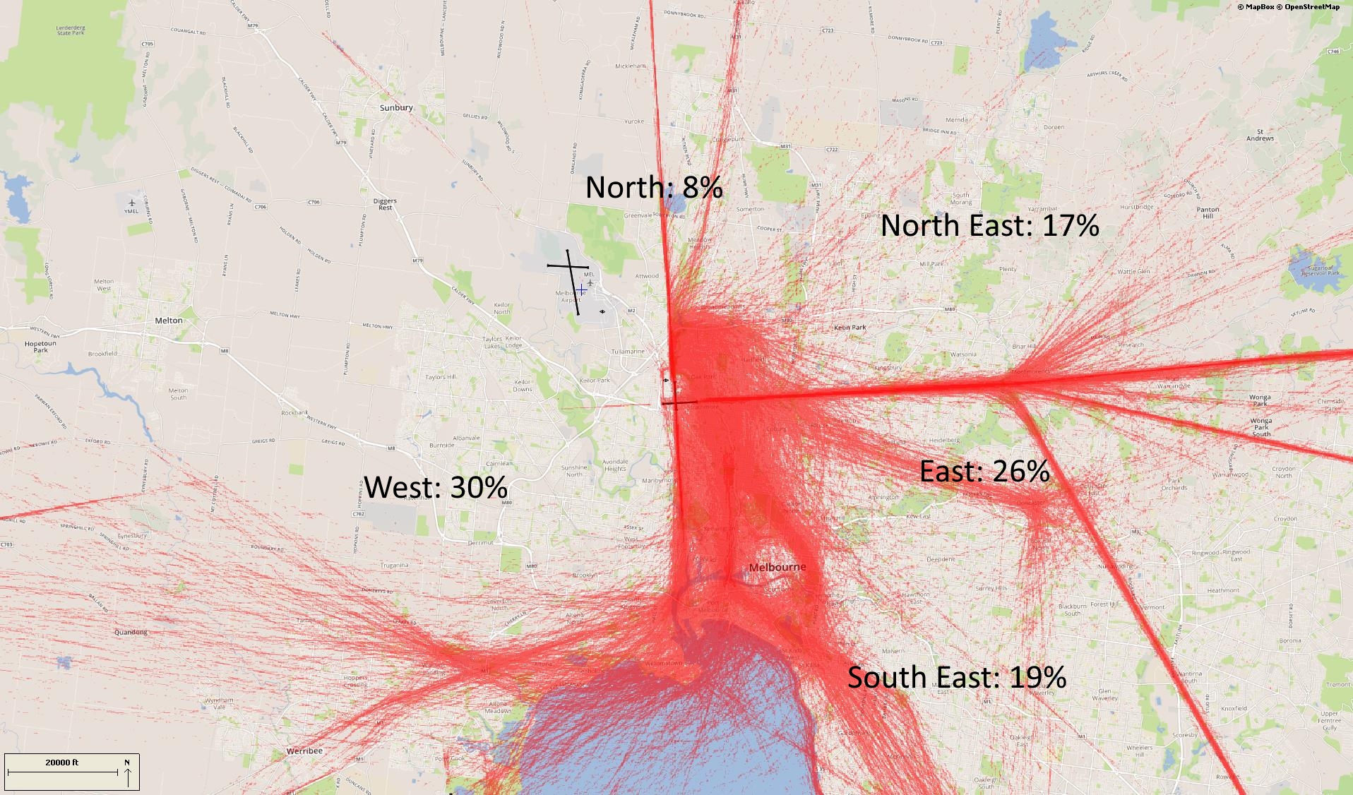
Aircraft inbound from the north may track via Craigieburn. Those from the north-east may track via Yan Yean Reservoir and Epping. When inbound from the east aircraft may track via Doncaster Shopping Centre and then either north or south of the airport or direct to the airport depending on which runway is in use.
Aircraft inbound from the south-east may track via major visual tracking points such as Albert Park and Station Pier or Westgate Bridge and then either via Moonee Valley Racecourse or direct to the airport.
From the south-west and west some aircraft will track coastal and via Laverton Bureau of Meteorological Tower, then get a clearance to track via Station Pier or Westgate Bridge and then via Moonee Valley Racecourse or direct to the airport.
The image below shows VFR and IFR arrival routes and the average percentage each VFR route is used.
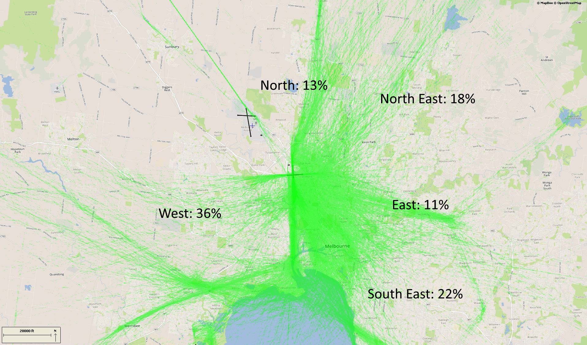
Outbound VFR aircraft will be cleared via one of the visual tracking points towards their destination.
The image below shows VFR departure routes and the average percentage each is used.
Coastal route
The coastal route runs from Carrum to the south of Moorabbin Airport and around to Altona South. This allows aircraft to track around the city and the Bay while keeping outside controlled airspace and therefore not needing a clearance from air traffic control. A large number of light aircraft use this route.
Training Area
Aircraft may use the coastal route to access the training area south-east of Moorabbin Airport, or the training area near Point Cook.
Scenic helicopter routes
A number of helicopter and fixed wing operators conduct scenic flights from Essendon Airport and Moorabbin Airport. The main scenic route sees the aircraft flying an orbit over the area around Docklands, Eureka Tower, Rod Laver Arena, the MCG and AAMI Stadium, Exhibition Building, and Eureka Skydeck 88.
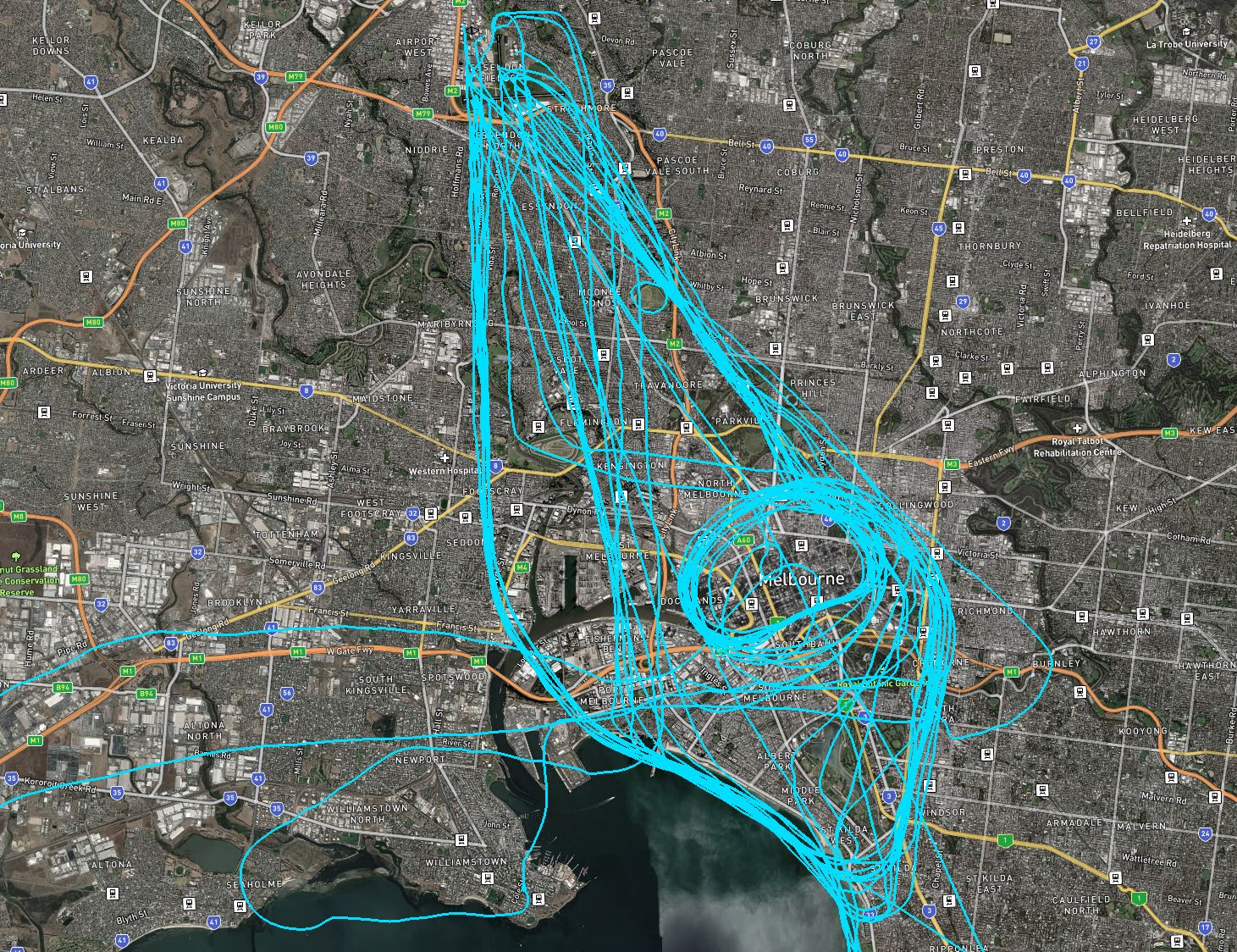
Other scenic flights head out of Essendon over Flemington Racecourse towards Port Philip Bay. This is followed by a coastal flight and then an orbit of the Docklands / MCG area. As shown in the image, above, routes can vary.
Flights are conducted at 1000 feet altitude over residential areas and 500 feet over water. Operators may choose to fly higher however in the area immediately around Essendon Airport and over the CBD passenger aircraft operate in the airspace directly above which limits the level scenic flights can ascend to.
