Melbourne Airport NAP 2: Preferred Flight Paths
The NAP lists the preferred flight paths as:
2.1 Minimum heights over densely populated areas (unless in the course of taking off or landing)
- Jet aircraft: 5,000 ft
- Non-jet aircraft: 3,000 ft
Note: This NAP is under review to determine how it can be reported.
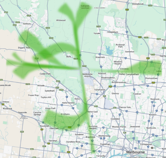
2.2 Departures
- Use standard departure paths (SIDs).
- If not, fly as close as possible to those paths and follow height rules.
Adherence with this procedure is reported below. SID operations are reported up to 10,000ft adherence.
This NAP notes the need to “approximate” the SID where the procedural SID is not being flown. As we worked on defining the corridor that aircraft should be within for approximation, initial reporting on this NAP prior to 28 November 2025 were departures using the procedural SID corridor only without any variance for approximation. As such, reporting accessed prior to 28 November will show a lower adherence result.
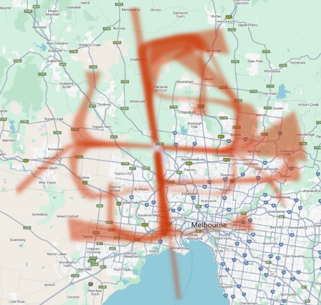
2.3 Arrivals
- Use standard arrival paths (STARs) where available.
- Radar vectors allowed.
Adherence with this procedure is reported below.
- Radar Vectoring – Air traffic controllers can sometimes guide a plane off the STAR route and give it specific headings (or “vector”) using radar to help it join the final runway-aligned landing path. Controllers do this to keep safe spacing between planes, manage traffic flow, and make the landing process more efficient.
This NAP notes that aircraft can be vectored at particular points which will take them off the STAR approach. As we worked on defining these points, initial reporting on this NAP prior to 28 November 2025 reported arrivals using STAR tracking only without variance for radar vectors. As such, reporting accessed prior to 28 November will show a lower adherence result.
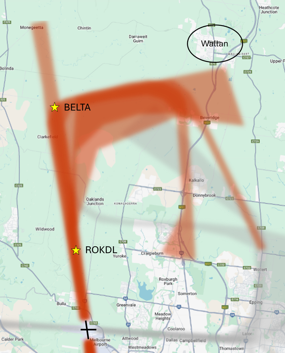
2.4 Runway 16 arrivals (arrivals from the north east turning left onto the long north-south runway)
- Use STAR via waypoint BELTA or
- Visual track via waypoint ROKDL with restrictions:
- no shortcutting early
- avoid flying low over Wallan (if not possible, then jet aircraft should be at or above 6000 ft whenever practicable)
Note: A waypoint is a geographical location used to define a point on a flight path. Waypoints are defined by geographic coordinates and typically take the form of a five-letter capitalised word e.g. BELTA, ROKDL, PORTS.
Adherence with this procedure is reported below.
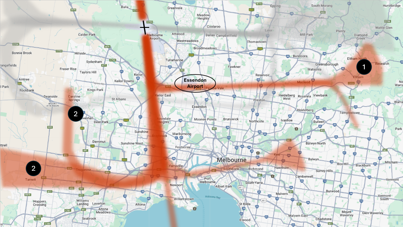
2.5 Runway 34 arrivals (arrivals from the south onto the long runway)
(1) Aircraft turning right to land:
- Use STAR via Essendon Airport, or if needed, may be radar vectored south of Essendon Airport to join the final runway aligned landing path
(2) Aircraft turning left or heading straight-in to land:
- Must follow applicable STAR, or
- between 6am–11pm only, may be radar vectored to join final runway-aligned section no closer than 3.5 Nautical Miles (roughly 6.5km) from touchdown
Adherence with this procedure is reported below.
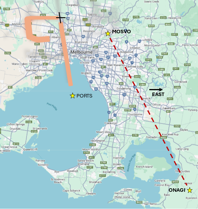
2.6 Night time arrivals (11pm–6am)
- Southeast arrivals must stay east of the ONAGI–MOSVO line
- Unless landing on Runway 09 or 34 using PORTS STAR
Adherence with this procedure is reported below.
Note: Air Traffic Control may adjust paths for weather and/or traffic conditions.
Standard Instrument Departures (SID) and Standard Instrument Arrivals (STARs) are published flight paths designed to enhance safety, efficiency, and predictability. Air traffic control (ATC) may issue a deviation to a SID or STAR due to weather and/ or traffic conditions.
The report below provides the percentage adherence against the NAP criteria for preferred flight paths.
“Other Operations” refers to operations where adherence was unable to be determined.
The report is best viewed in full screen mode.
Note: Due to rounding, percentage values may not sum to exactly 100.0%. Minor discrepancies of up to ±1% are expected and do not indicate any errors in the underlying absolute figures, which remain accurate and unaffected.
