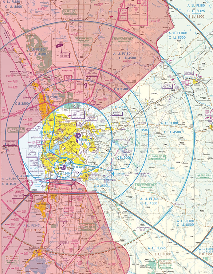
Perth Airport Flight Paths

Flight paths for Perth Airport are designed around military airspace to the north, west and south, and Jandakot Airport airspace to the south. Military restricted areas are shown in pink in the image at right. Click to enlarge and use your back button to return to this page.
Military airspace
Military airspace (see image at right) can be active to ground level or it can begin at a certain altitude. Some military airspace is active only at certain times of the day and week. Where possible, flight paths are designed to remain under military airspace or to fly over the top of it. The close proximity of RAAF Base Pearce to the north means that air traffic controllers at Perth Airport have to coordinate their actions with RAAF controllers, including for changes of runway direction.
Flight path information
You can access historical information about flight path use through WebTrak. To access this information click the “Historical” link below the text in the Quick Start Guide at the top left-hand side of the screen. Then use the tick boxes at the bottom-right of the screen to select monthly, quarterly or yearly information. Use the sliders to refine your selection to specific timeframes.
To learn more about the runway at Perth Airport, take a look at our Perth Airport Runway page.
The illustration below shows how jet and non-jet (turbo-prop) aircraft typically operate at Perth Airport on the published instrument arrival and departure flight paths.
The animation is indicative only and provided for information purposes, on occasions flights may leave these general areas from time-to-time.


