Helicopter and nearby routes
The airspace surrounding Brisbane Airport is controlled from the ground level up. The base of the controlled airspace rises moving outwards from Brisbane Airport, with the airspace below the base being uncontrolled. Light aircraft and helicopters often remain in uncontrolled airspace to remain separated from large passenger aircraft that transit through controlled airspace.
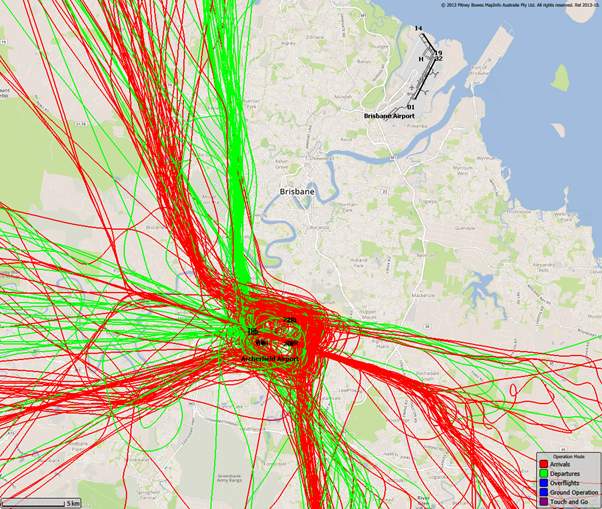
The following image shows light aircraft and helicopter movements in uncontrolled airspace throughout the Brisbane region. As you can see, these flights remain clear of Brisbane Airport:
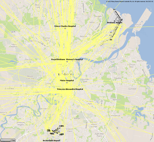
This however does not mean light aircraft and helicopters are restricted from entering controlled airspace. In order to access this airspace, the aircraft operator requires an airspace clearance and is obligated to abide by air traffic control directions once in the controlled airspace. In the Brisbane region, the most common user of this airspace apart from Brisbane Airport traffic is medical helicopters flying to and from local hospitals. The following image shows some of these flights:
Archerfield Airport also has a pocket of controlled airspace surrounding the airport. A difference to Brisbane’s controlled airspace though is that Archerfield’s is only active from 7:00am – 5:00pm. Outside of these hours the airspace around Archerfield is uncontrolled.
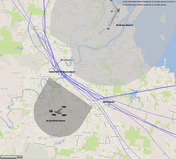
In busy airspace where there is a mix of controlled and uncontrolled airspace, lanes are often established to ensure pilots transiting through the airspace remain outside of controlled airspace. One such lane passes between Brisbane’s and Archerfield’s control zones. The following image shows aircraft using this lane. The control zones for Brisbane Airport and Archerfield Airport are shaded grey. Pilots navigating along these lanes do so with visual reference to landmarks that are easy to recognise from the air which in this case is the University of Queensland and the brickworks in Rochedale. Both of this places are referenced on the map: