Light aircraft and helicopter routes – south

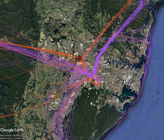
There are a number of routes around Sydney used by light aircraft and helicopters.
It is not mandatory that light aircraft and helicopters fly on these routes. As you will see from the images below which show the tracks of actual flights, some aircraft may fly the whole route but others may only fly part of it, joining or leaving it depending on their purpose or destination. Other aircraft may not use the routes at all.
These routes are mainly outside controlled airspace (“OCTA”), that is, aircraft are not being directed by air traffic control. Whenever they fly outside controlled airspace, pilots are following the rules of the air. Our booklet, Guide to our Operations, explains more about different types of airspace.
Pilots using these routes are usually flying under Visual Flight Rules, which means they navigate using landmarks that are easily seen from the air. This does not mean they must fly over each landmark; rather, they use each landmark to be sure of their position.
Most of these routes lead to and from Bankstown Airport, as shown in the images above and below.
To and from the south and south-west
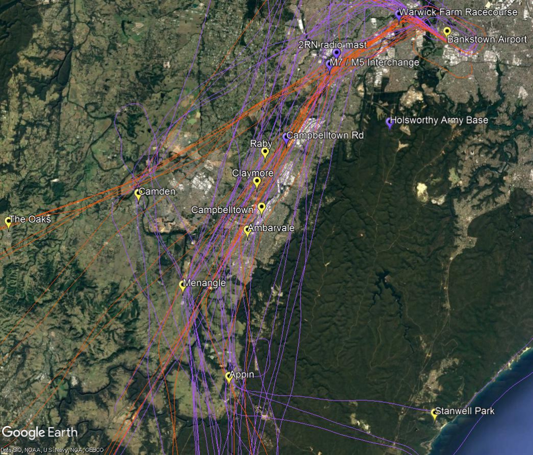
The image below shows actual aircraft tracks. Aircraft inbound to Bankstown Airport are coloured orange and outbound are purple.
From the south-west aircraft track towards Camden and then via the 2RN radio mast and the M7/M5 interchange and Warwick Farm Racecourse. From the south aircraft may track via Appin to Campbelltown Road and the 2RN mast.
If outbound to the south, aircraft will commence to climb to 2500 feet after passing the Liverpool to Parramatta railway line. The M7 motorway is a tracking feature for the turn to the south. Aircraft need to avoid restricted airspace around Holsworthy Army Base so will track towards Campbelltown and Appin. At Appin aircraft must be below 4500 feet to stay out of controlled airspace. If heading for the coast they will fly west of Appin then turn east towards Stanwell Park. By Stanwell Park aircraft must be at or below 2,500 feet to remain outside controlled airspace.


