Helicopter routes from Sydney Airport
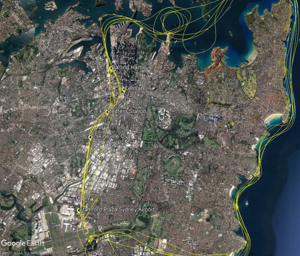
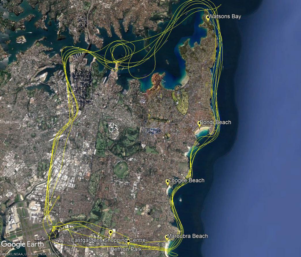
There are helicopter routes between Sydney Airport, the harbour and the coast. Scenic helicopter flights in these areas are becoming increasingly popular, especially on weekends and holidays.
Helicopters will fly these routes in one of two ways outline below. Helicopters may fly outside these routes if (for example):
- they are bound for other destinations, or
- by direction of air traffic control, or
- if they are conducting “airwork” such as aerial filming, photography or surveying, shark spotting, or
- if they are performing emergency services operations.
Option 1: To/from the north
Helicopters inbound to Sydney Airport from the north will track from Darling Harbour to Central Railway station, usually at 1000 feet. Altitudes may vary on instruction by air traffic control. They will then follow the railway line to Redfern Station. From there they track to Erskineville Oval before descending to 500 feet while tracking to The Stamford Hotel on the outskirts of the airport. Instructions are then given for tracking to the helipad.
Outbound helicopters track via The Stamford to Erskineville Oval and then via Redfern Railway Station and the railway line to Central, and then to Darling Harbour, all at 1,000 feet.

Option 2: To/from the West
Helicopters inbound to Sydney Airport from the west will track from Maroubra Beach to Heffron Park on Bunnerong Road and to Eastgardens Shopping Centre at 1,000 feet. From there they towards Southern Cross Drive while descending to 500 feet (altitudes may vary on instruction by air traffic control). They are then given instructions by air traffic control for tracking to the helipad.
Outbound helicopters track via Southern Cross Drive to Eastgardens Shopping Centre at 1,000 feet and then to Maroubra Beach. Once east of the coast they will descend to 500 feet which is the minimum altitude for flight over water.


