Sydney Airport flight path over the north-west – south flow
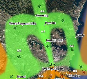
North-western suburbs of Sydney are overflown by aircraft travelling northwards to join the final approach to the parallel runways (flight path A2 in the image at right). This occurs when the parallel runways are being used in a southerly direction (“south flow”).
Aircraft on this flight path are being “vectored” by air traffic control. This means each aircraft is being given its own heading and altitude to allow it to intercept the final approach path, while maintaining safe separation from all the other aircraft around it.
These aircraft are well into their descents for landing and are continuing to descend under air traffic control instructions. This means that the altitude of each aircraft will vary according to how far it has left to fly before intercepting the final approach and the altitudes of other aircraft in the area. Aircraft will generally intercept the final approach at around 2500 to 3000 feet in altitude.
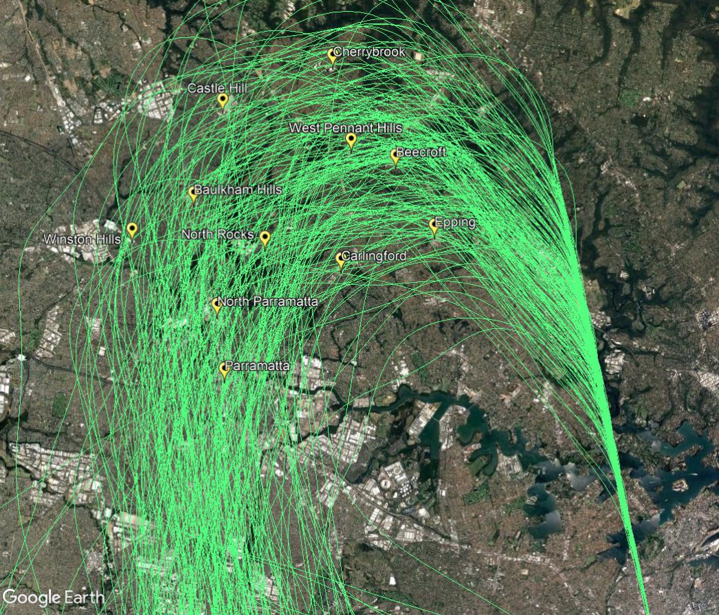
The image below shows the actual tracks of aircraft being vectored to join the final approach. The final approach path is the concentrated straight line at the bottom right of the image. This path leads directly to the runway. The image shows the spread of aircraft that is created by the act of vectoring. This spread is deliberate as it is part of the noise sharing strategy set out in the Long Term Operating Plan for Sydney Airport.