Camden Airport circuits
Circuit training is the first stage of practical pilot training, focused on take-offs and landings. It involves the pilot making approaches to the runway, touching down and then applying power to take-off again.
Circuit training is undertaken at most airports, particularly regional and general aviation aerodromes. How a circuit is flown and its location is determined by the Civil Aviation Safety Authority.
The animation below shows how a circuit is typically flown. it has been created using typical tracks which are shown in blue whilst an animated aircraft flies the circuit. The circuit will only be used by one aircraft at any given time.
The animation illustrates the degree of variation that will occur in the way pilots fly circuits. The altitudes above mean sea level of the aircraft are also shown. You can enlarge to full-screen by clicking the square-shaped button in the bottom right-hand corner of the player.
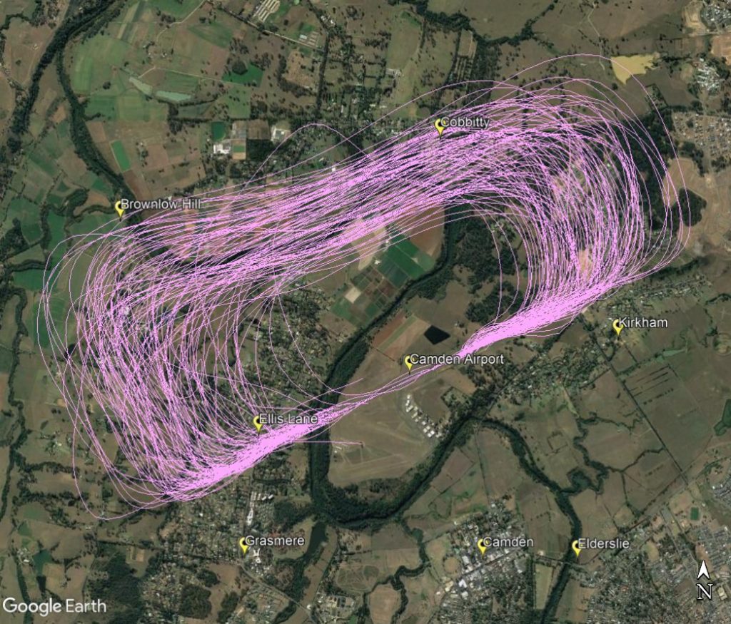
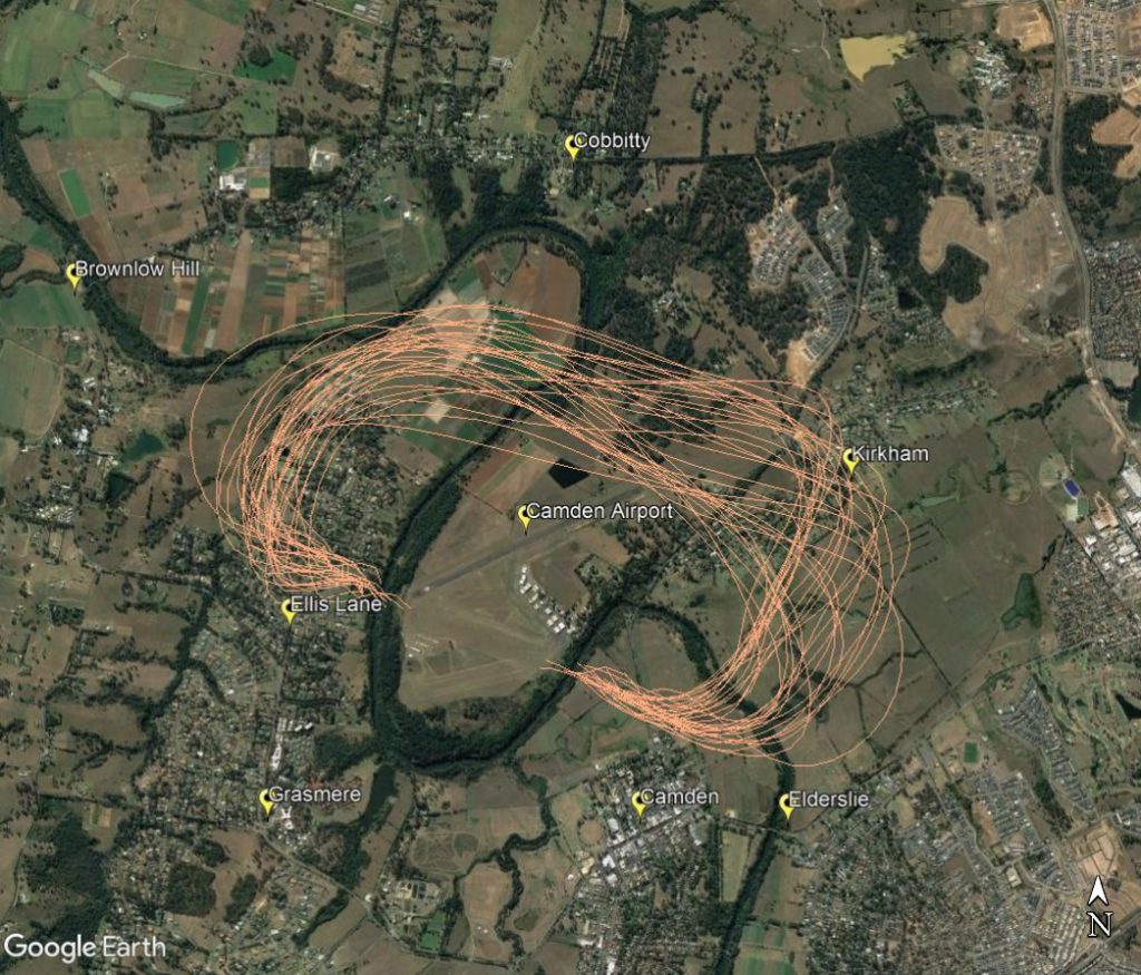
The following images show the typical paths taken by aircraft flying the circuit at Camden using both runways available at the airport. The runway direction is selected using the wind direction.
Circuits conducted on the north-west side of the airport with Ellis Lane and Cobbity affected by either the crosswind or base legs as shown in the image below.

Circuits conducted on the north-east side of the airport with and parts of Ellis Lane and Kirkham affected by the crosswind and base legs as shown in the image below.

For information on circuit training hours and aircraft altitudes see our Camden Airport Rules page.
Important information for residents near circuit training airports
Aircraft movement information in this portal may inaccurately count some low-level flights at Secondary airports.
Why is this so?
The aircraft movement data comes from the radar located close to the major airport which is used by air traffic control to manage aircraft within controlled airspace. Low-level flights around secondary airports, such as circuit training flights, can be partially hidden from the radar’s line of sight by buildings and hills, potentially making counts inaccurate.
Learn more
Learn more about how radar coverage affects counting of low-level aircraft movements at secondary airports in our Help and Technical Information page, available in the resources section.


